R2_P2-P3
Detailed pole information
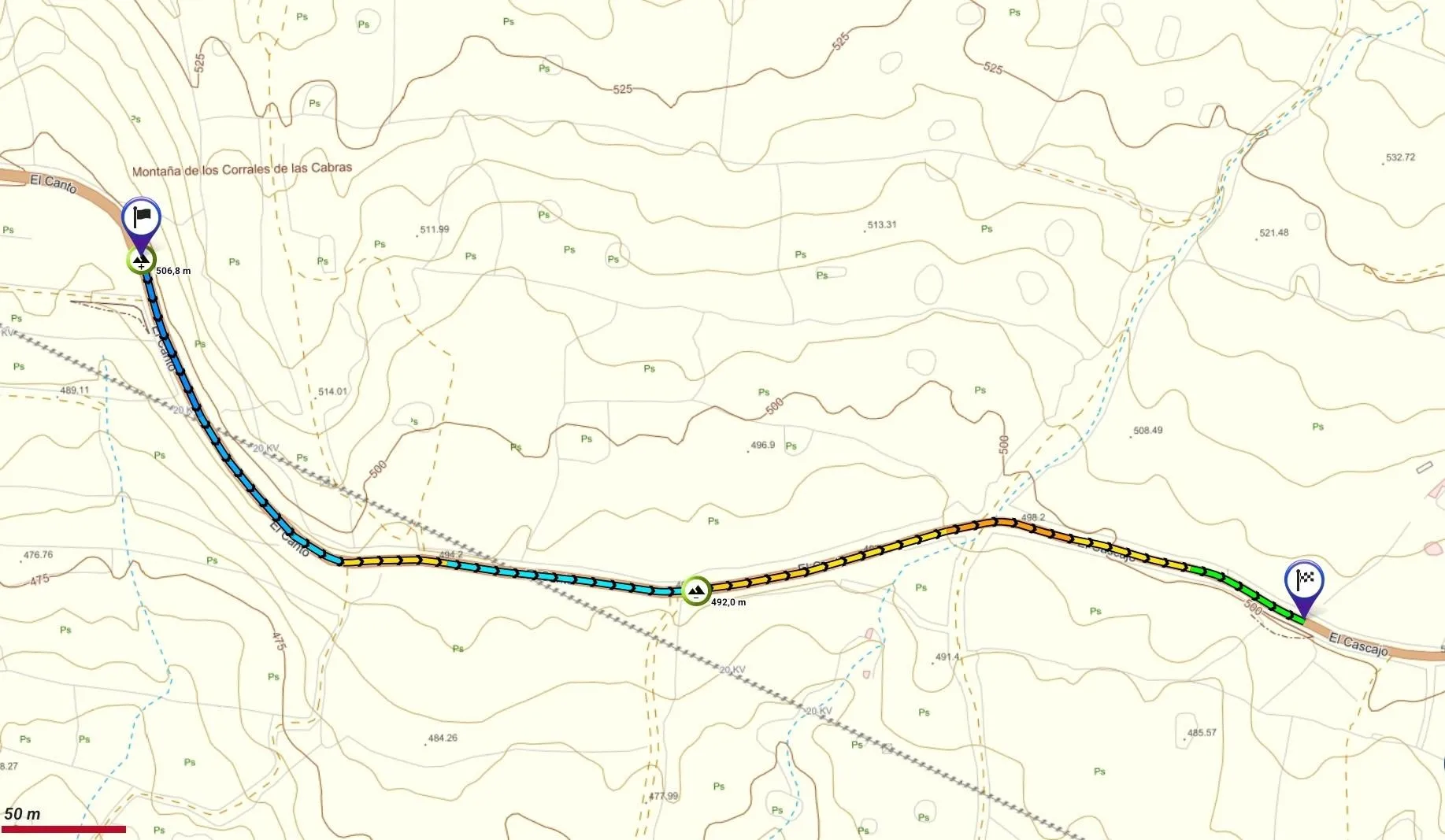
This pole is part of the trail El Mentidero - El Canto - El Cascajo in the Ramal 2. A strategic point of the route that will help you orient yourself during your journey.
Pole Details
All technical information of the point
Description
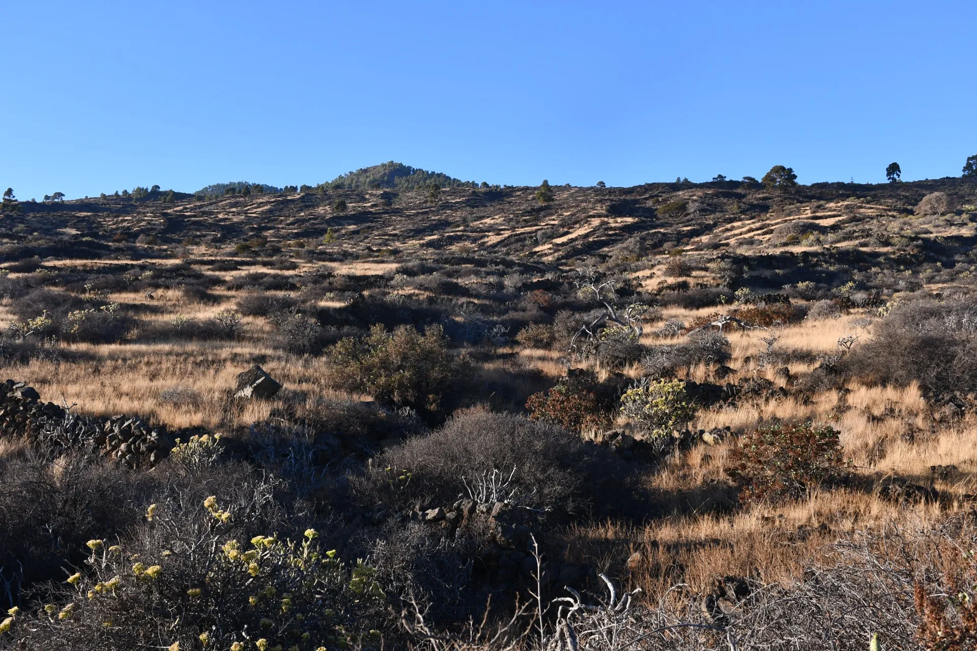
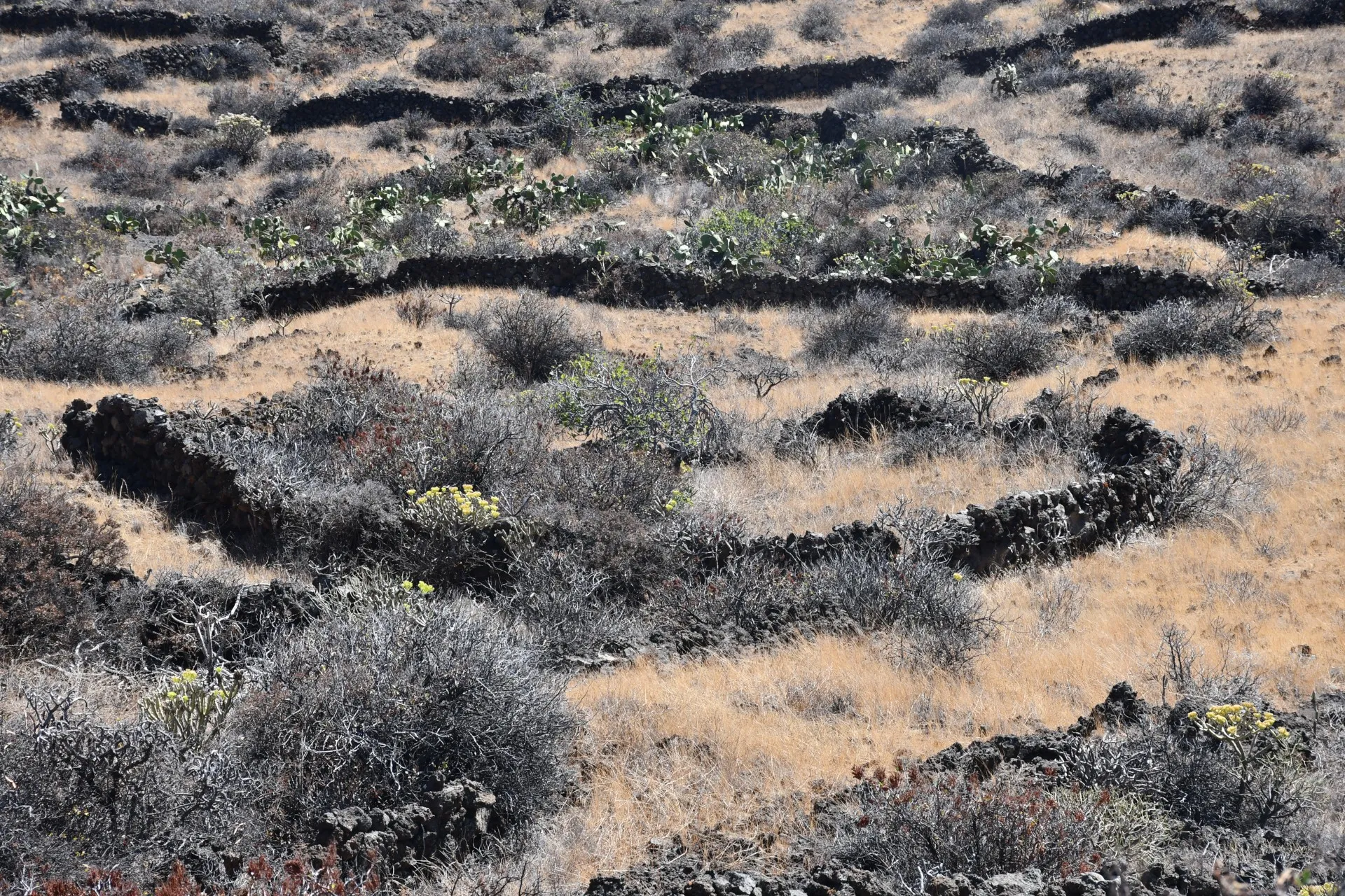
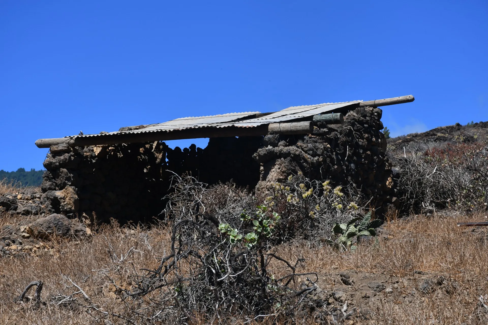
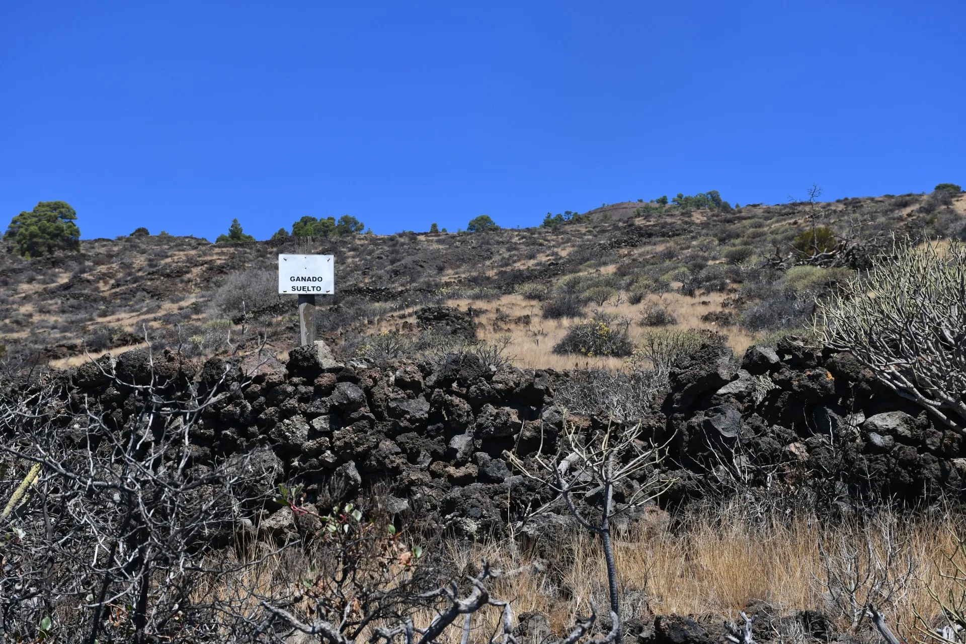
As hikers progress along this stretch, the importance of pastoral activity in this area of the island—both past and present—becomes increasingly apparent, clearly reflected in both local toponymy and the landscape itself.
Regarding toponymy, for example, the trail begins on the southwestern slope of Mount Los Corrales de las Cabras ("Goat Enclosures") and ends in the area bearing the same name. In terms of landscape evidence, this is manifested in various ways: the remnants of some of these livestock enclosures scattered across the territory, some abandoned while others are still in use today; the presence of small signs warning of free-ranging animals; and the numerous “góranes” visible here and there.
The word “goran” comes from the language of the Canary Islands’ aboriginal inhabitants and refers to circular dry-stone enclosures built either to contain livestock or to protect the valuable vegetation inside, typically fig trees (Ficus carica), from being eaten.
Additionally, the way in which the scrubland has gradually and naturally reclaimed space, both inside and outside these "góranes", reflects the slow abandonment of traditional pastoral practices over time.
Datos Técnicos
| Branch | Ramal 2 |
|---|---|
| Coordinates | 27.683464, -18.006493 |
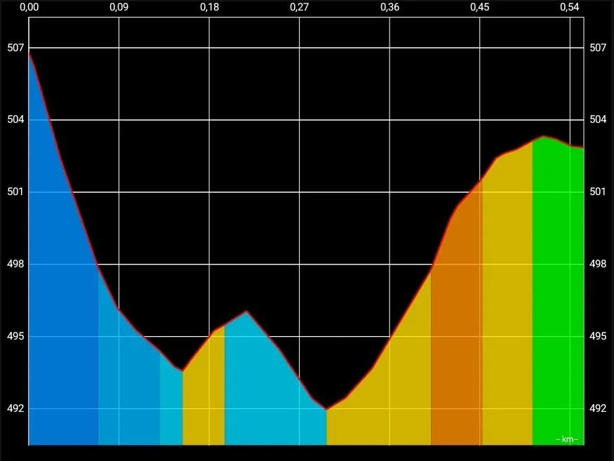
| Maximum altitude | 506 m |
| Minimum altitude | 491 m |
| Distance (Ascending) | 0,32 km |
| Distance (Descending) | 0,15 km |
| Duration | 9min 30s |
Pole Location
View the exact location of the pole