R2_P3-P4
Detailed pole information
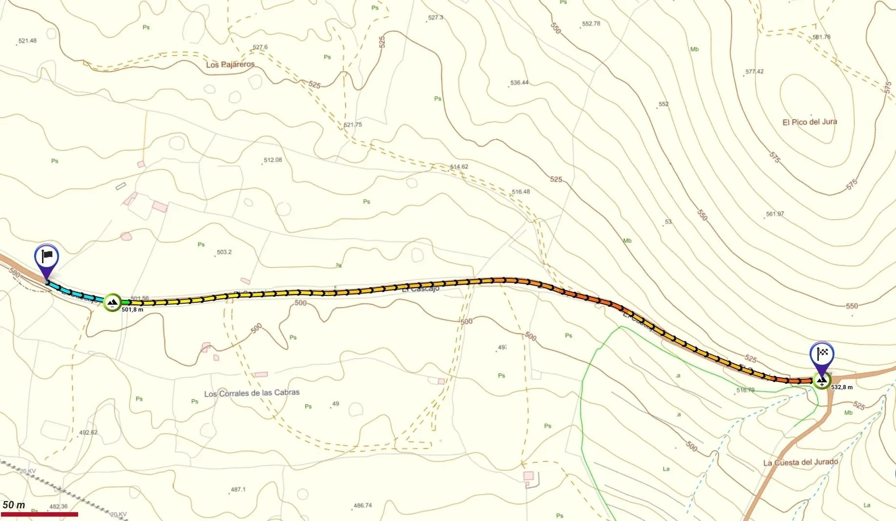
This pole is part of the trail El Mentidero - El Canto - El Cascajo in the Ramal 2. A strategic point of the route that will help you orient yourself during your journey.
Pole Details
All technical information of the point
Description
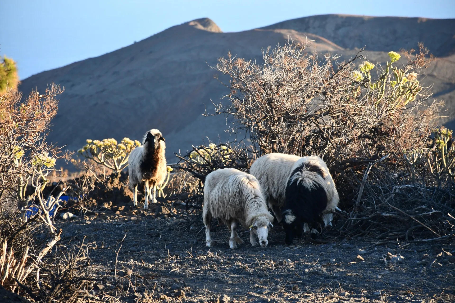
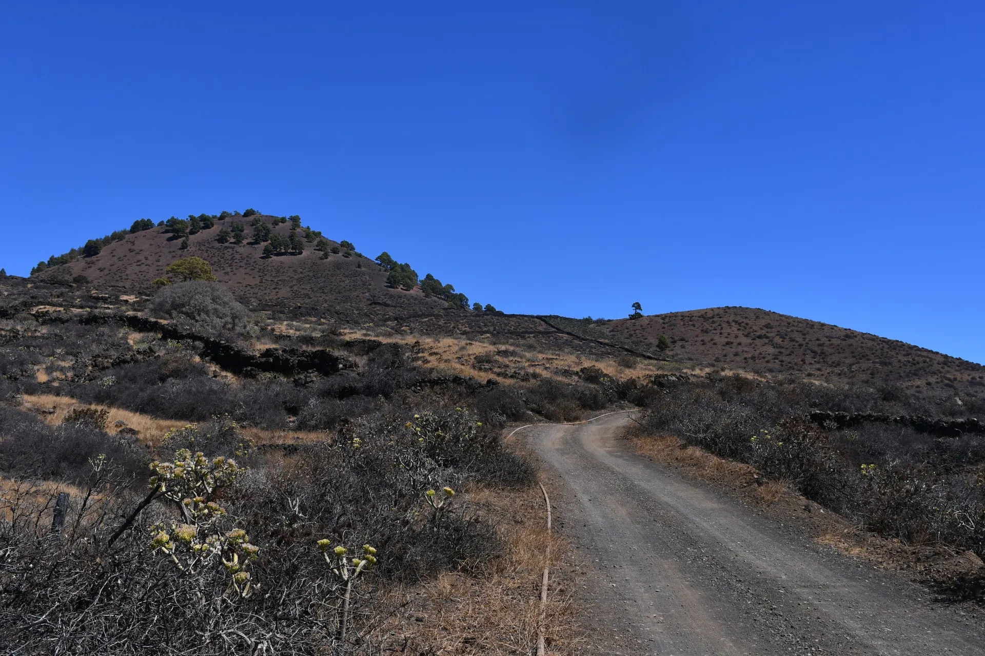
The trail continues along this stretch, slightly ascending and heading east toward the volcanic crater known as Pico del Jurado. From the start, hikers can observe clear signs of ongoing pastoral activity, with corrals containing goats and sheep kept in semi-free-range conditions.
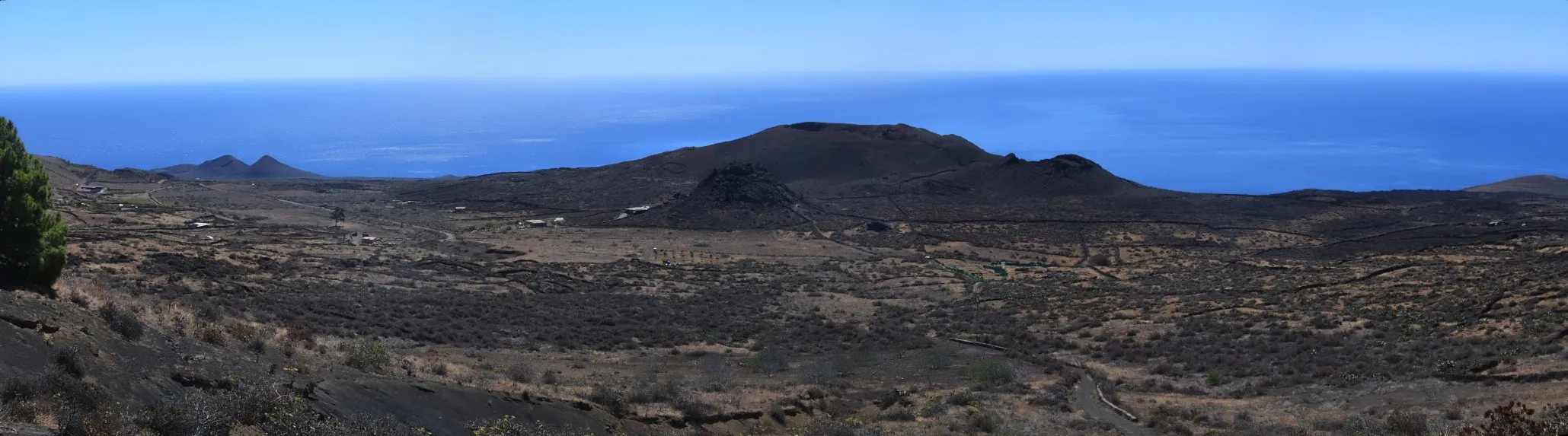
Looking southward from this area, the full extent of a series of volcanic craters —collectively known as “Los Roques”— comes into view, with the easternmost part forming a plateau called “La Hoya de Los Roques”. Today, this area is primarily used for agriculture and livestock, but during the first half of the 20th century it served as a quarantine site for patients with tuberculosis and other contagious diseases.
Additionally, these remote landscapes provided refuge for some residents of El Pinar known as “Los Huídos” (The Fugitives), who remained hidden for several years following the Spanish Civil War to escape persecution under the Franco dictatorship.
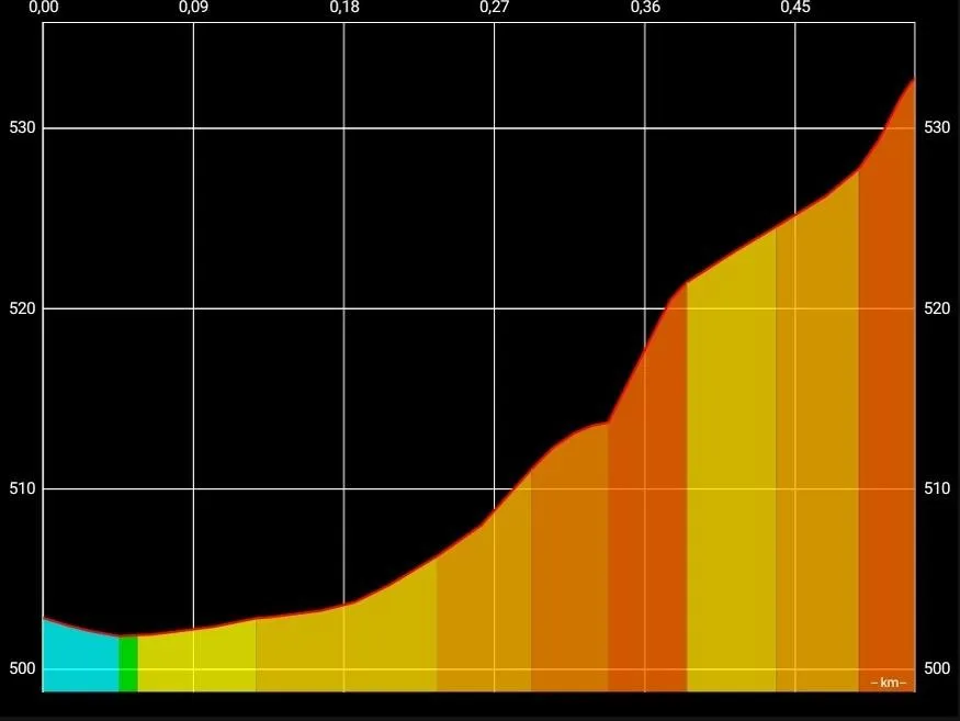
Datos Técnicos
| Branch | Ramal 2 |
|---|---|
| Coordinates | 27.682133, -18.001719 |
| Maximum altitude | 532 m |
| Minimum altitude | 501 m |
| Distance (Ascending) | 0,52 km |
| Duration | 8min 58s |
Pole Location
View the exact location of the pole