R2_P4-P5
Detailed pole information
This pole is part of the trail El Mentidero - El Canto - El Cascajo in the Ramal 2. A strategic point of the route that will help you orient yourself during your journey.
Pole Details
All technical information of the point
Description
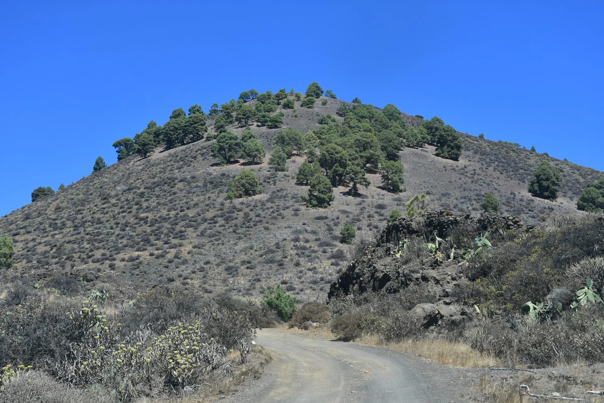
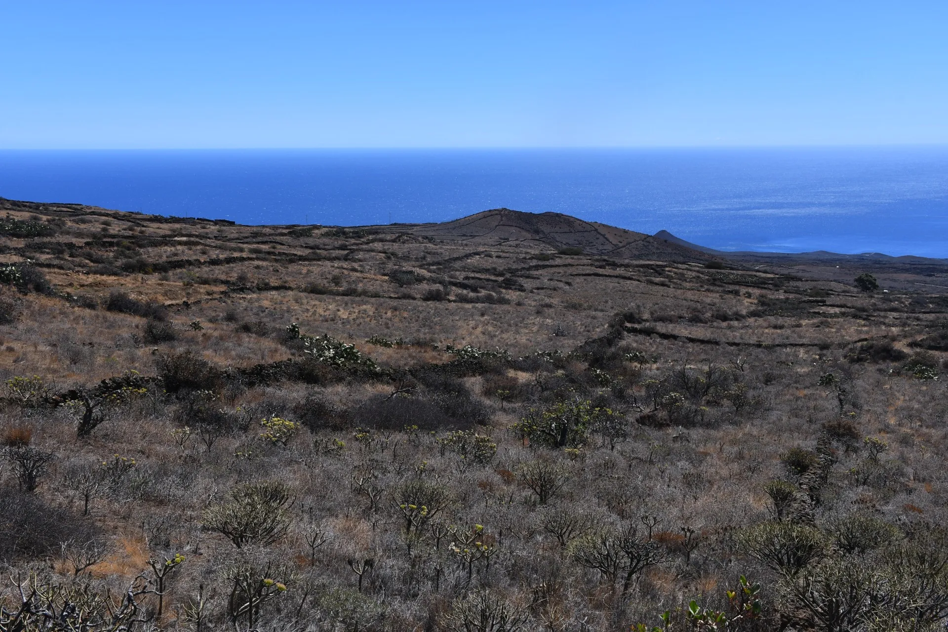
From this point, the trail turns northeast, leaving the sea behind and bringing the imposing presence of Tembárgena Volcano into the main view. This stretch ends at the southern foothills of the volcano. On its slopes, whose highest point exceeds 750 meters, hikers can spot the southernmost remnants of the pine forest on the island, marking the lower limit of its altitudinal distribution.
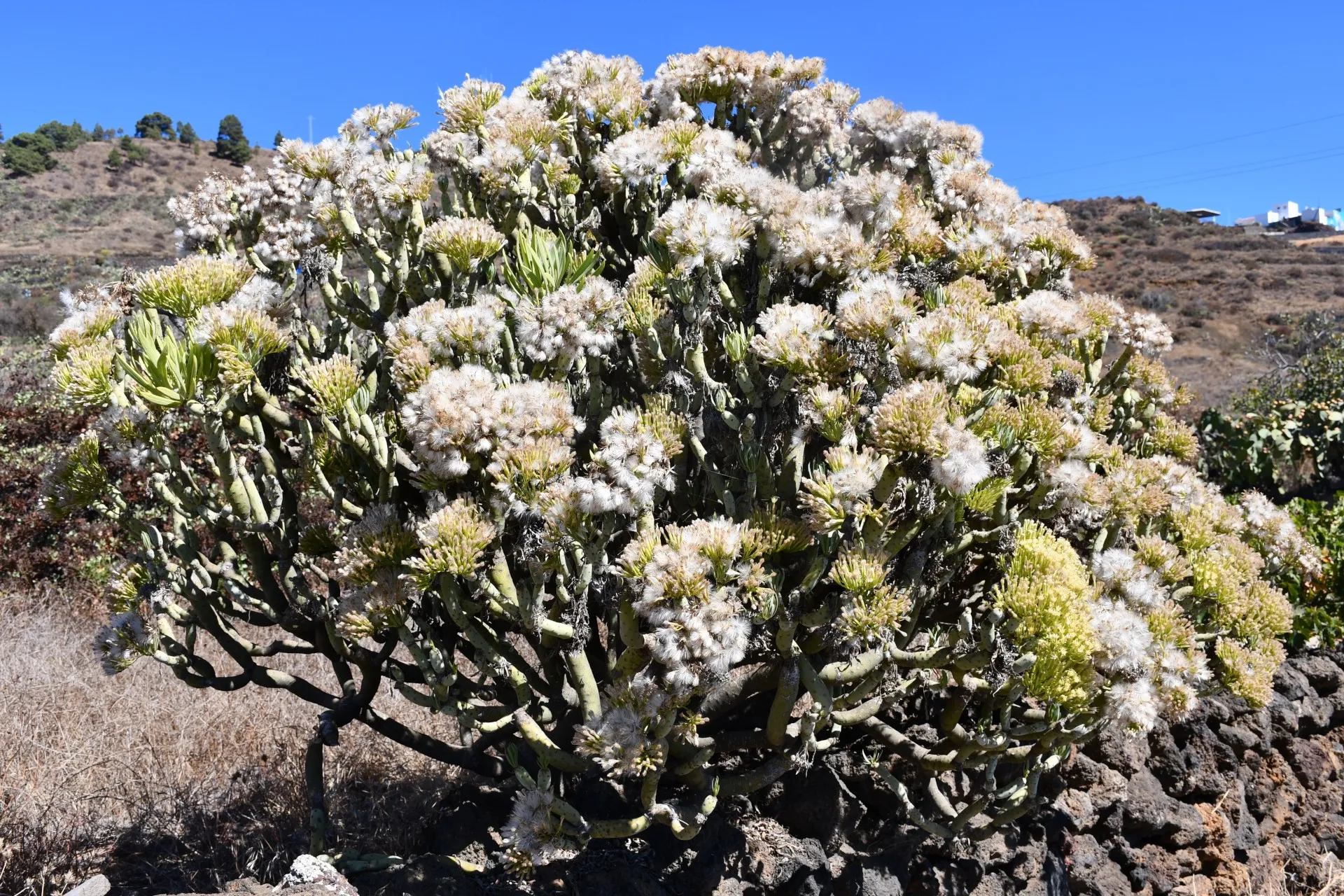
Along this section, in addition to the volcano itself, the landscape is dominated by scrubland that has naturally and spontaneously replaced the pastures and cereal and fig tree fields that once covered these lands when human intervention was much more pronounced. This scrub consists mainly of "calcosas" (Rumex lunaria), "tabaibas" (Euphorbia lamarckii), and "berodes" (Kleinia neriifolia).
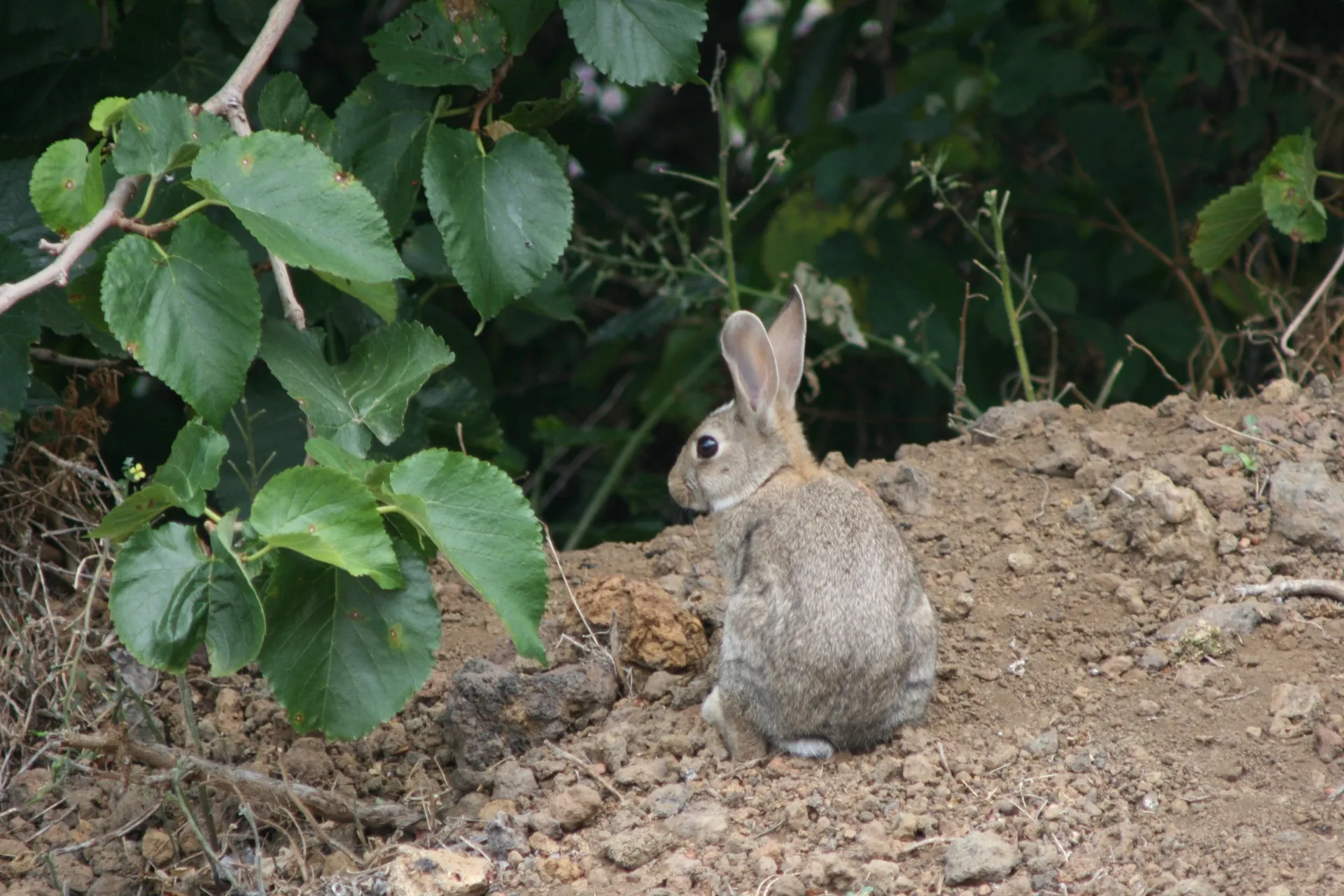
Historically, the stems of the more robust "berodes" were used to make “corchos” —wooden carriers whose interior, being fresh and cool, allowed hunters to transport ferrets (Mustela putorius) used in rabbit hunting (Oryctolagus cuniculus). Along the dirt track throughout this branch, it is still common to see rabbits hopping from one side to the other, seeking cover and avoiding human presence.
Datos Técnicos
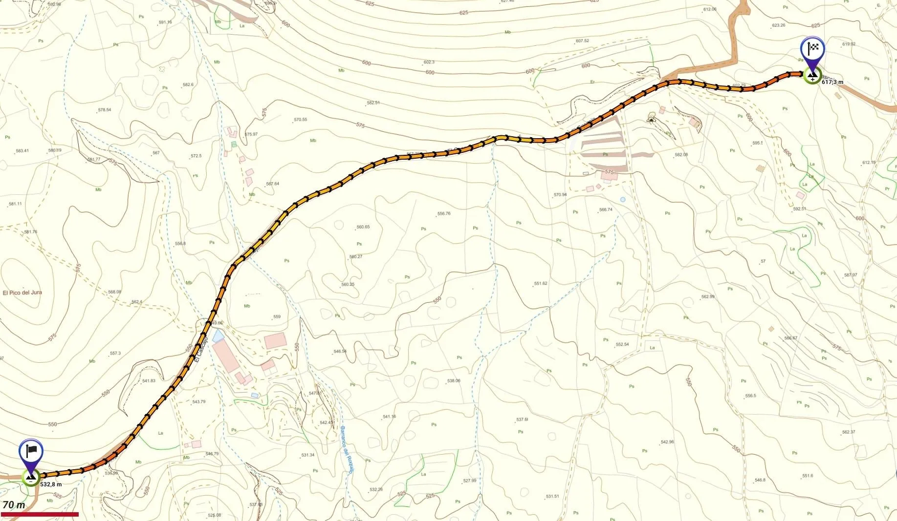
| Branch | Ramal 2 |
|---|---|
| Coordinates | 27.681558, -17.996591 |
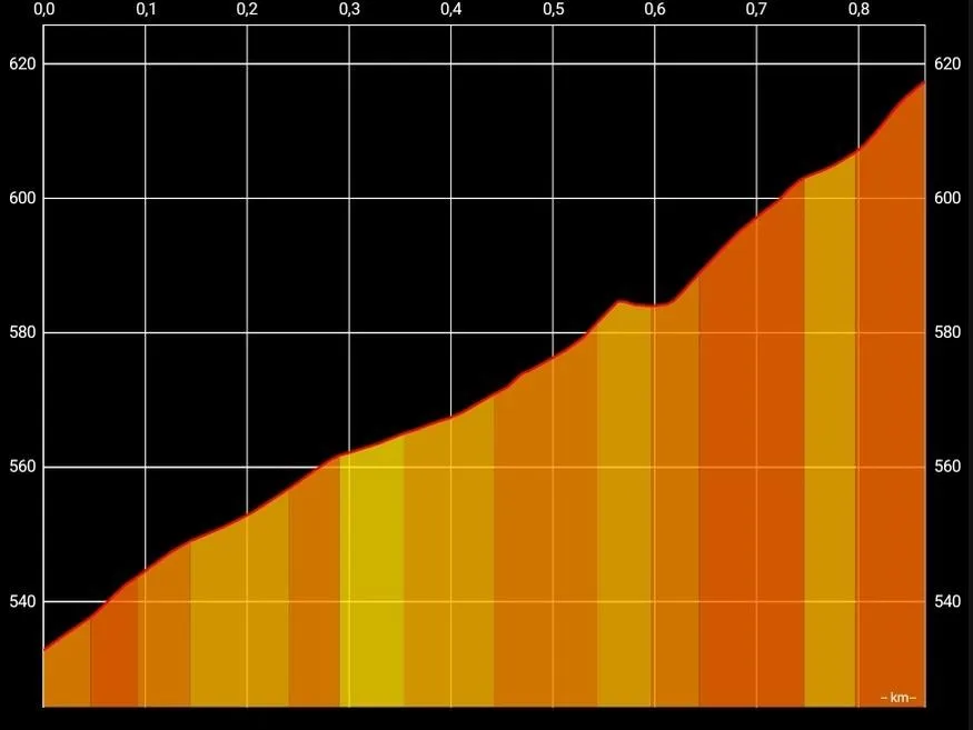
| Maximum altitude | 617 m |
| Minimum altitude | 532 m |
| Distance (Ascending) | 0,87 km |
| Duration | 14min 51s |
Pole Location
View the exact location of the pole