R2_P8-P9
Detailed pole information
This pole is part of the trail El Mentidero - El Canto - El Cascajo in the Ramal 2. A strategic point of the route that will help you orient yourself during your journey.
Pole Details
All technical information of the point
Description
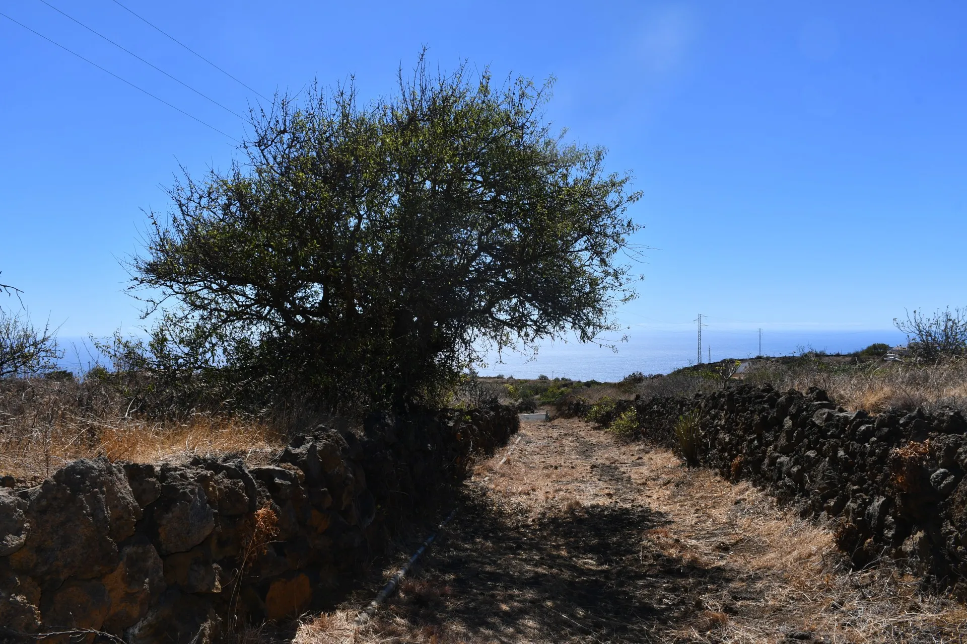
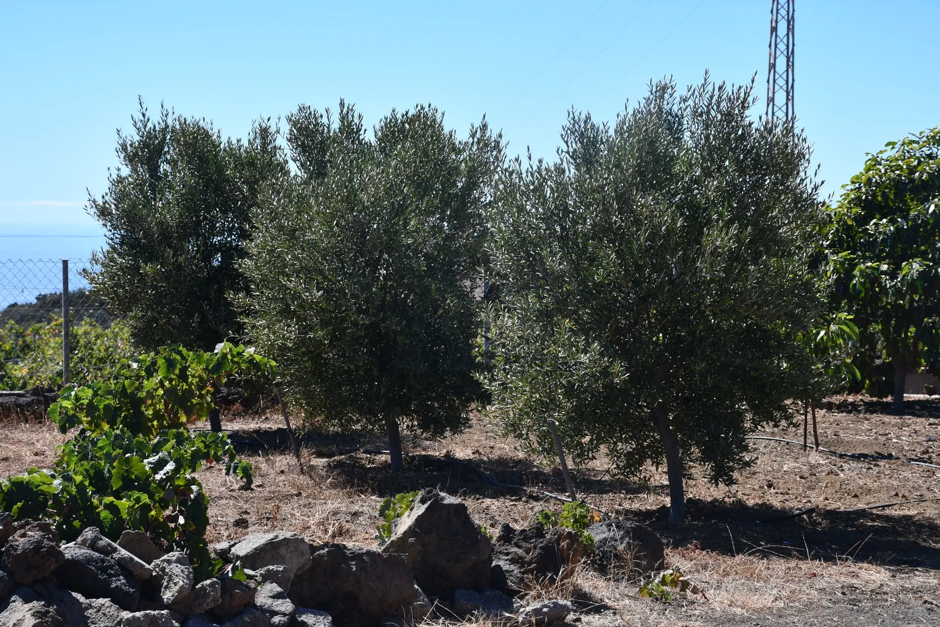
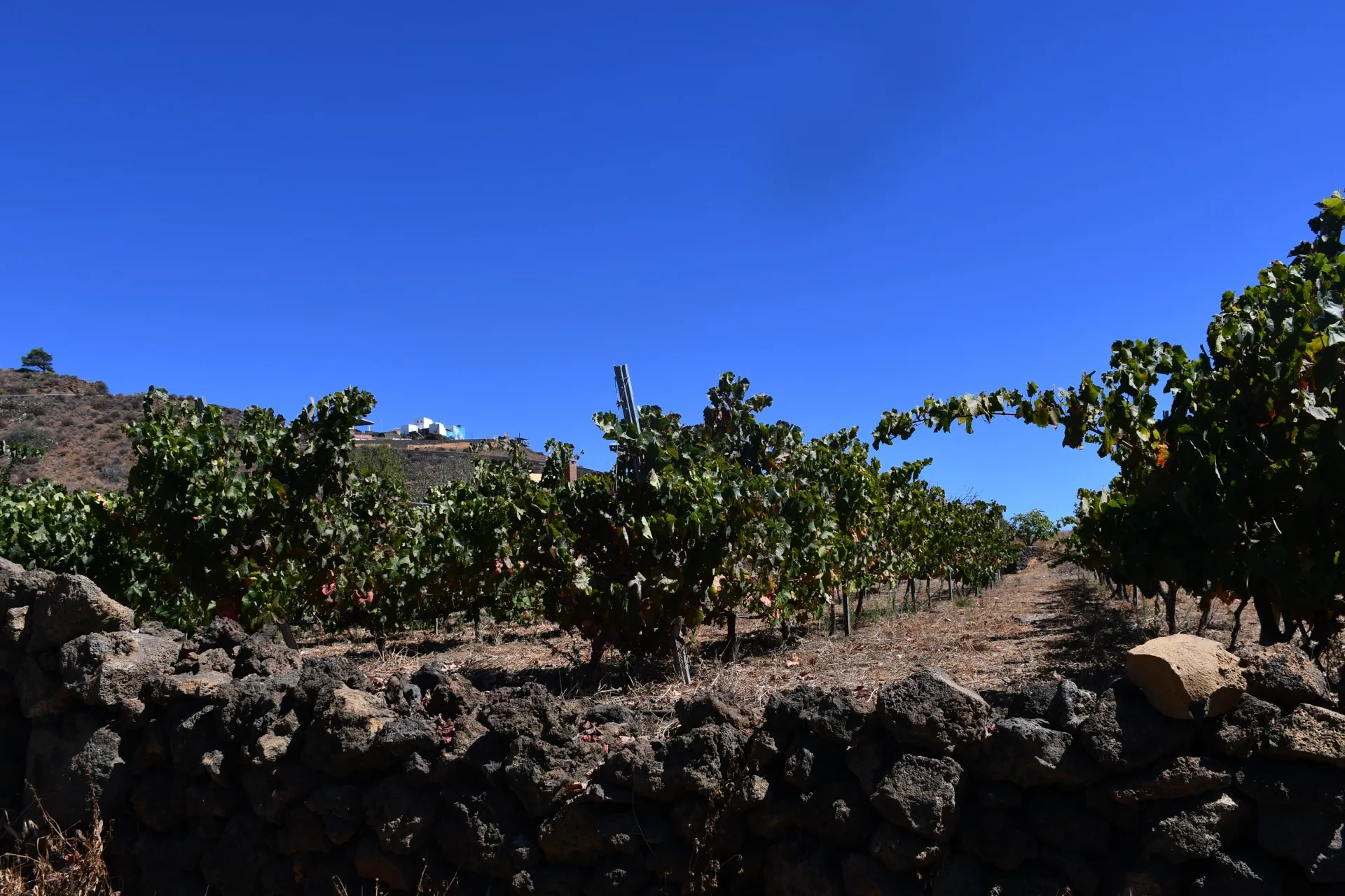
This final section of Branch 2 runs almost straight and steadily uphill toward the northwest, crossing the areas of Los Llanos to the west and Ladera de la Hoya to the east. It begins along a mule track that winds through terraced fields and small farms, where a few almond trees (Prunus dulcis), fig trees (Ficus carica), and olive trees (Olea europaea) can be seen. However, these terraces are mainly dedicated to small-scale vine cultivation (Vitis vinifera).
These vineyard terraces are a perfect example of what is known as “heroic viticulture” —the practice of growing vines under challenging geographical conditions, such as steep slopes, stone-walled terraces, and high elevations (above 500 meters above sea level). Here, mechanization is virtually impossible, and all work must be done by hand, demanding both great physical effort and deep dedication, resulting in landscapes of striking beauty.
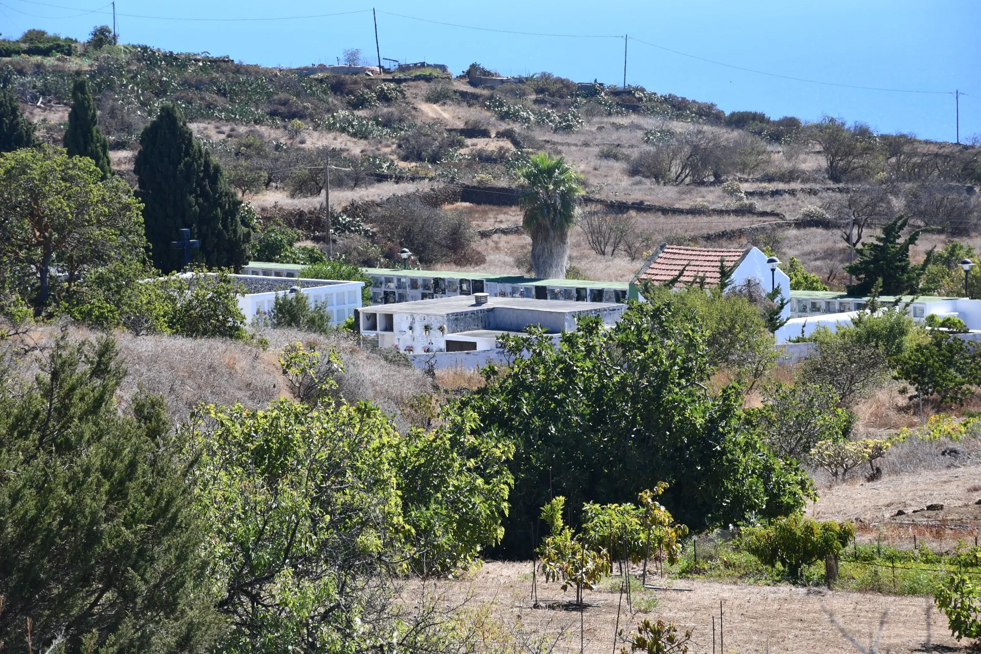
As the path continues and crosses the paved track of La Hoya, there is a point from which hikers can see the cemetery of El Pinar. A historical event tied to this cemetery remains deeply etched in the collective memory of the community: during the Spanish Civil War, mock executions were carried out here in an attempt to intimidate local men and women into revealing the whereabouts of neighbors and relatives who had fled and gone into hiding across the island to escape reprisals under the Franco dictatorship— an effort that ultimately failed to break their spirit.
Datos Técnicos
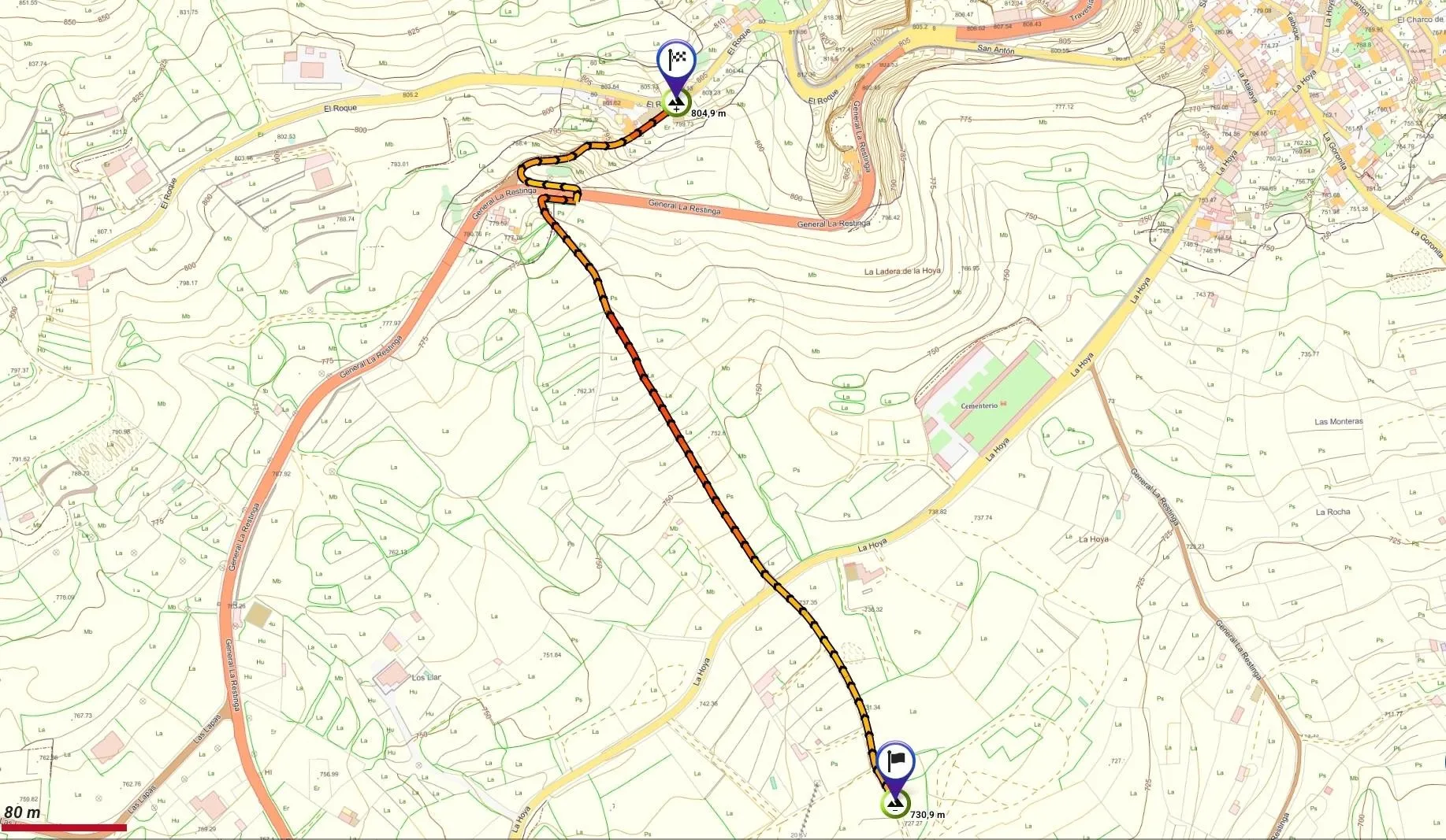
| Branch | Ramal 2 |
|---|---|
| Coordinates | 27.696930, -17.981672 |
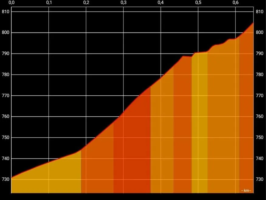
| Maximum altitude | 804 m |
| Minimum altitude | 730 m |
| Distance (Ascending) | 0,65 km |
| Duration | 11min 6s |
Pole Location
View the exact location of the pole