R1_P6-P7
Detailed pole information
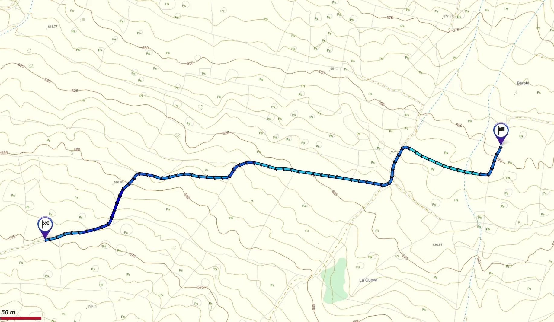
This pole is part of the trail El Mentidero - El Canto - El Cascajo in the Ramal 1. A strategic point of the route that will help you orient yourself during your journey.
Pole Details
All technical information of the point
Description
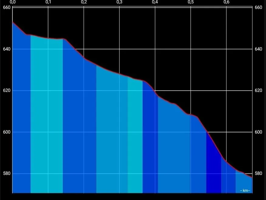
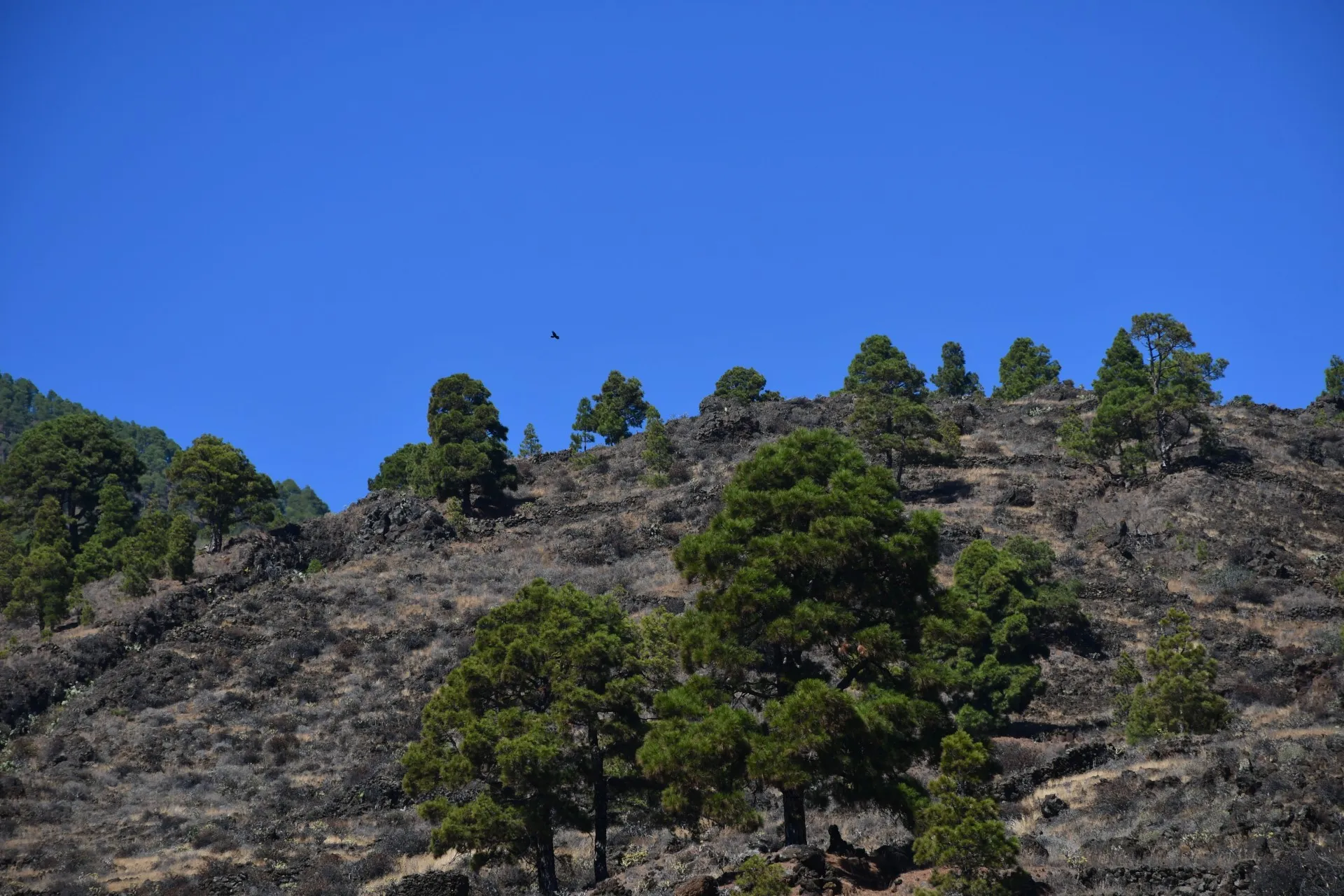
From this point, the trail continues downhill along the same mule track, where the slope can become noticeably steeper in places. The track also follows a slightly zigzagging route, so hikers are advised to pay close attention to the trail markers and changes in direction to avoid losing the path. For example, about 200 meters from the start of this section, there is a signposted fork near a small grove of pines atop a minor volcanic crater known as Mount La Cueva. At this junction, continue east to reach the end of Branch 1 in the El Canto area, while heading south connects with the start of Branch 4, leading toward the El Cascajo dirt track.
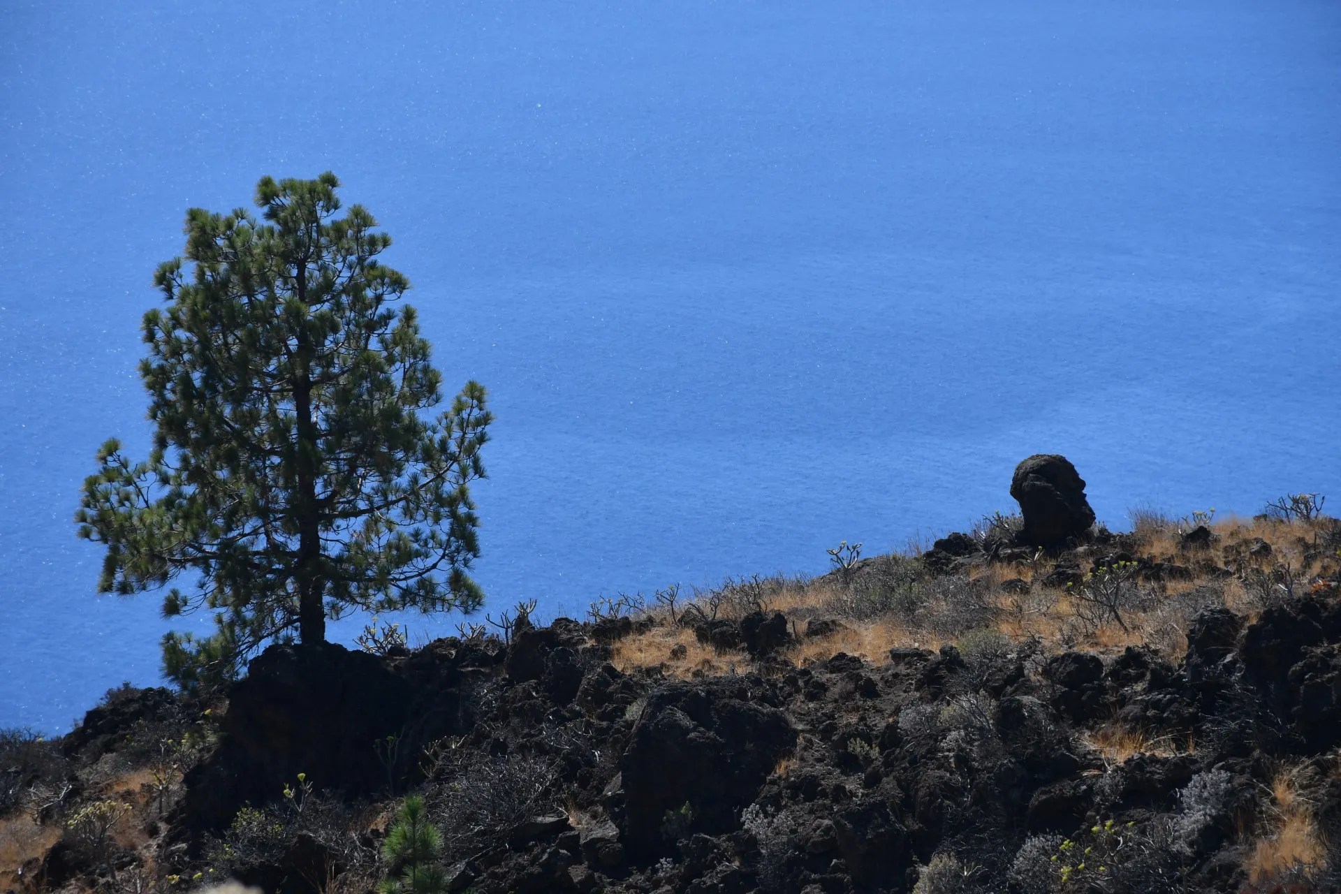
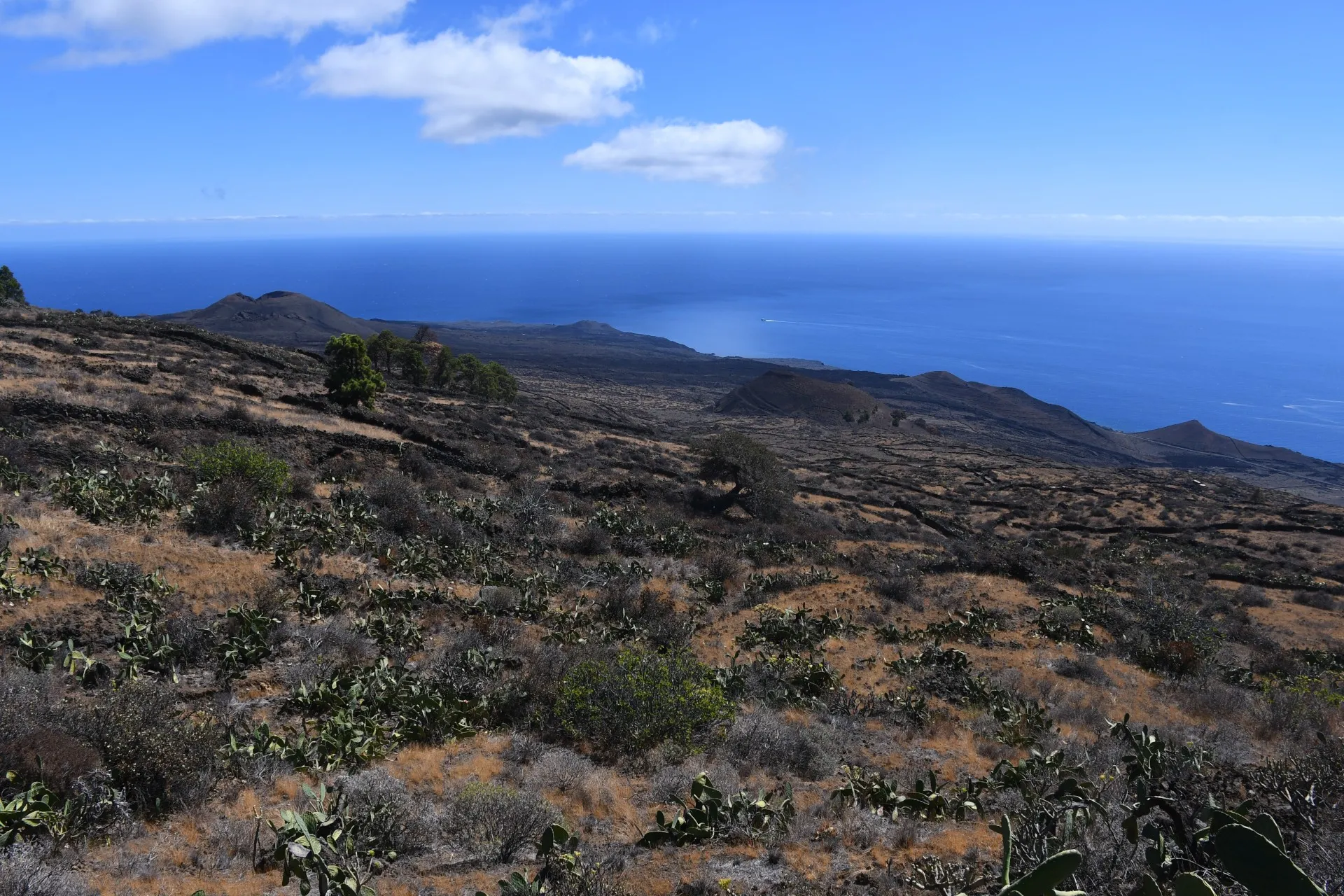
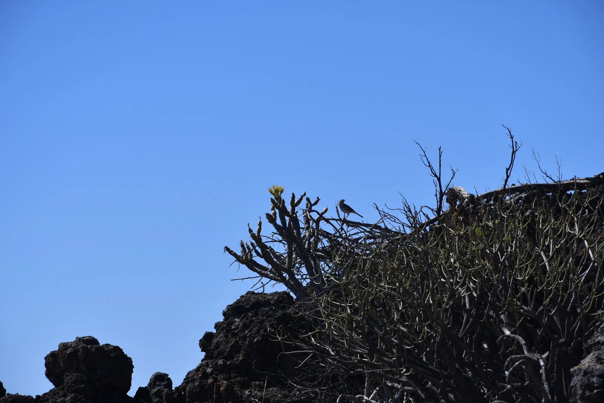
In this area, increasingly removed from recent human influence, visitors can enjoy a landscape dominated by the ochre tones of low-lying scrub, dotted with dry-stone walls, craters, and volcanic bombs of all sizes, set against the striking blue backdrop of the Sea of Las Calmas. The remoteness of the area and the absolute silence—interrupted only occasionally by the whisper of the wind, the song of "camineros" (Anthus berthelotii) and "chorreros" (Curruca melanocephala), or the caw of a raven (Corvus corax canariensis) flying above the upper pines—creates the perfect atmosphere for imagination to take flight. Here, visitors may even experience pareidolia, the phenomenon by which phantom faces or human figures seem to appear among the petrified shapes of the volcanic landscape.
Datos Técnicos
| Branch | Ramal 1 |
|---|---|
| Coordinates | 27.689765, -18.008019 |
| Maximum altitude | 653 m |
| Minimum altitude | 578 m |
| Distance (Descending) | 0,67 km |
| Duration | 11min 33s |
Pole Location
View the exact location of the pole