R1_P4-P5
Detailed pole information
This pole is part of the trail El Mentidero - El Canto - El Cascajo in the Ramal 1. A strategic point of the route that will help you orient yourself during your journey.
Pole Details
All technical information of the point

Description
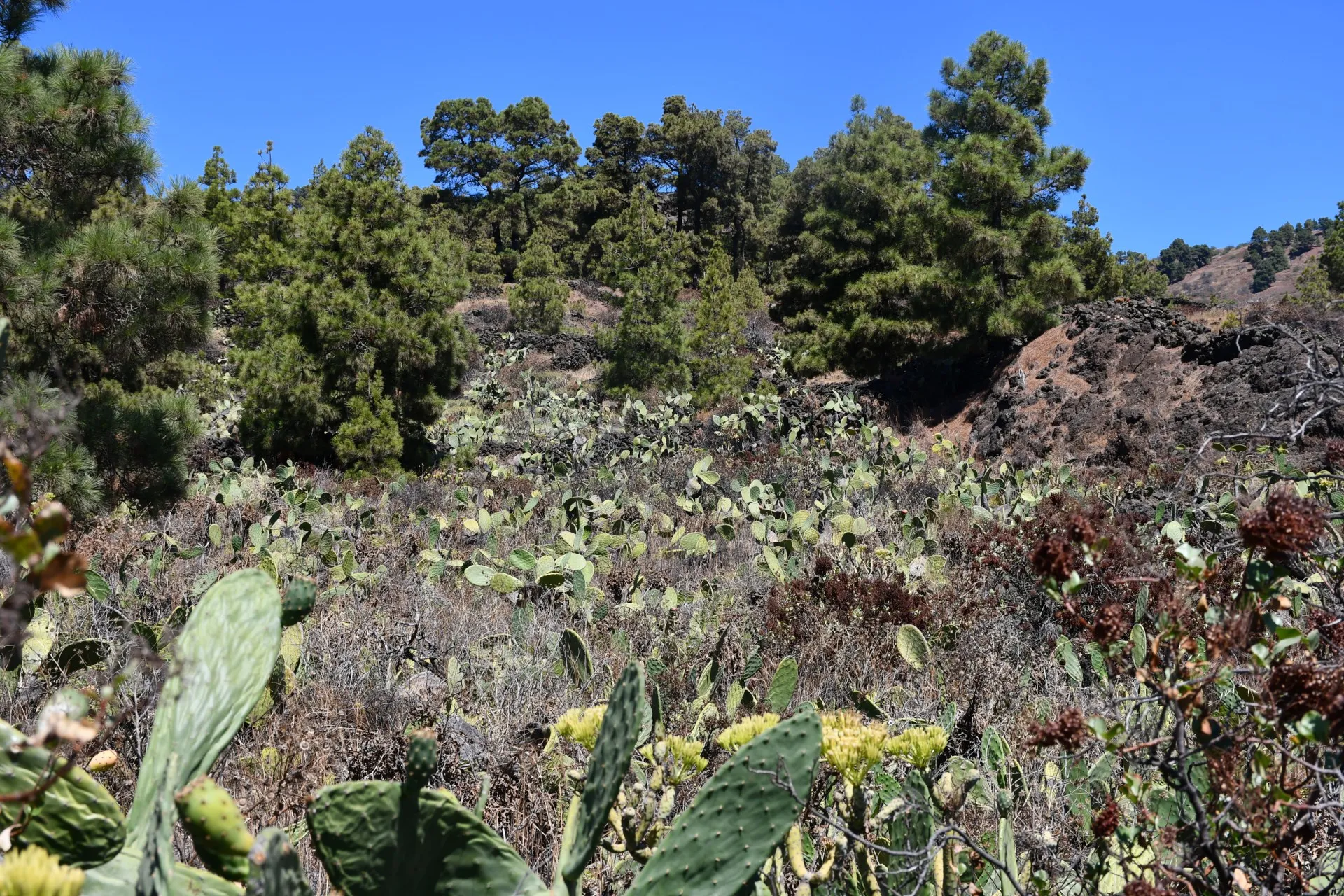
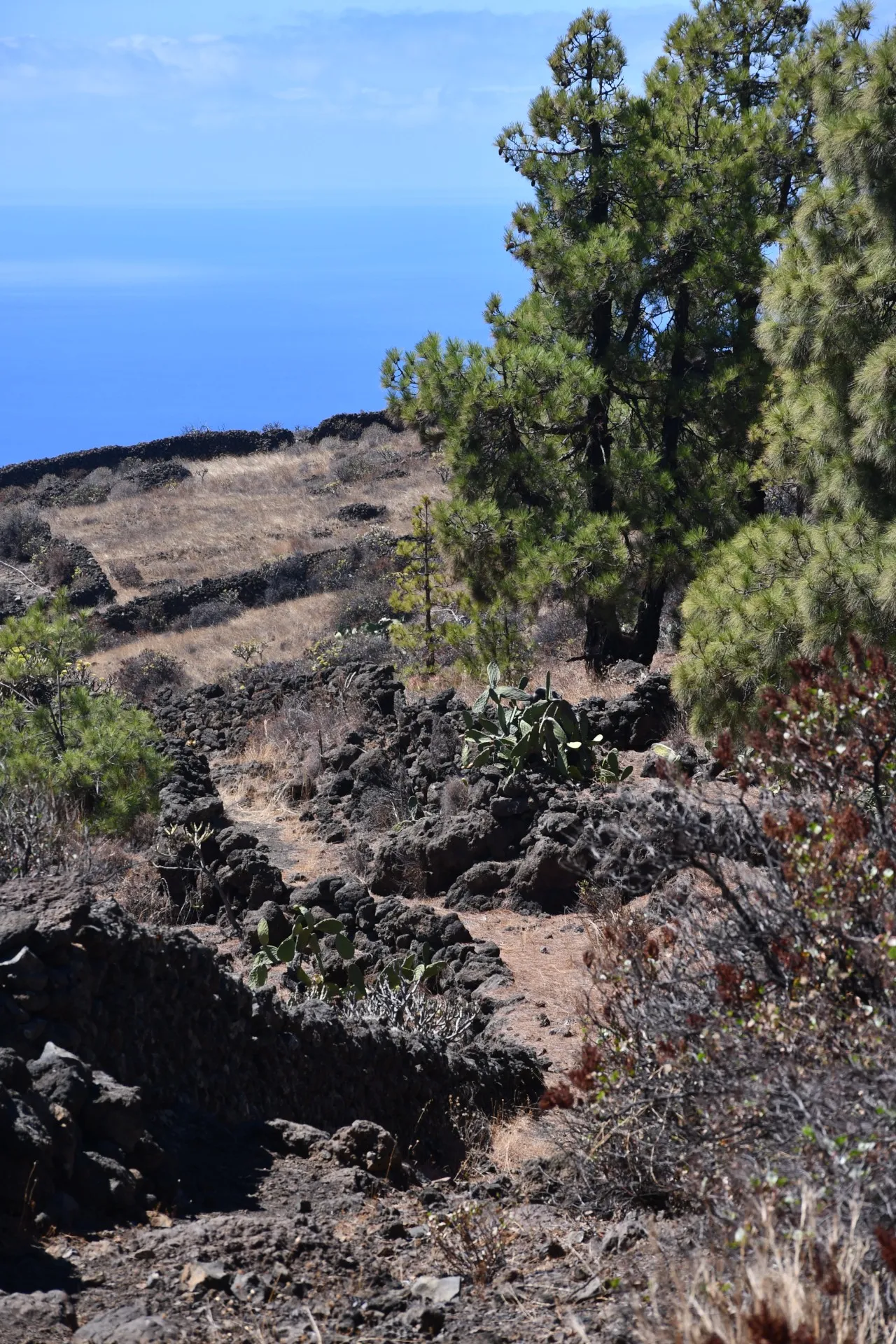
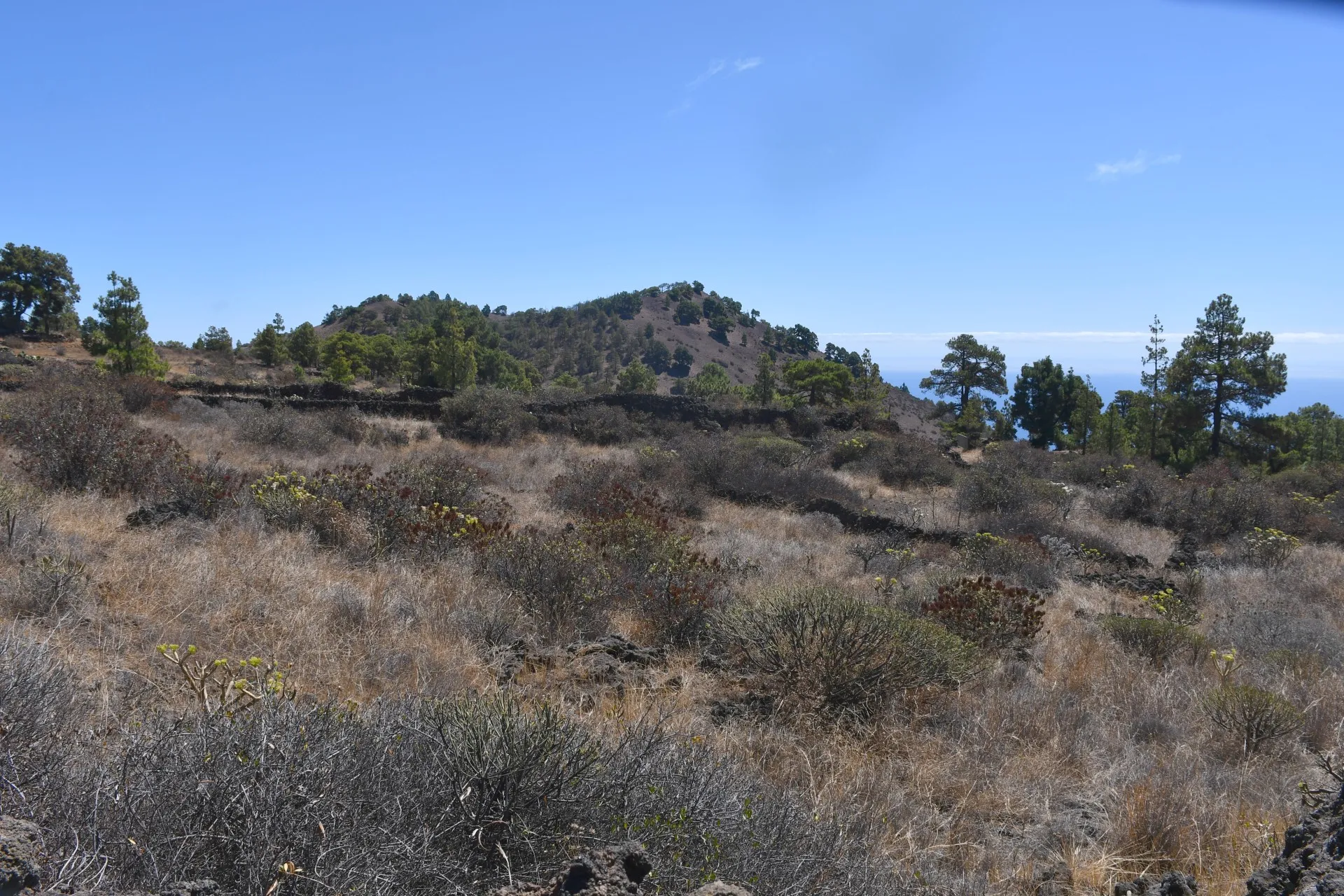
From the ridge of La Pelada, the trail continues downhill along the dirt track of Camino del Bérote, skirting the northern slopes of Mount Talpino. Here, the Canary Island pines (Pinus canariensis) become increasingly scattered and isolated, and amid the characteristic local scrubland —"berodes" (Kleinia neriifolia), "calcosas" (Rumex lunaria), and "tabaibas" (Euphorbia lamarckii)— numerous "tuneras" (Opuntia maxima) can be seen. These resilient plants offer a clear idea of their historical significance as a source of sustenance, capable of thriving and bearing edible fruits under harsh conditions with minimal human intervention.
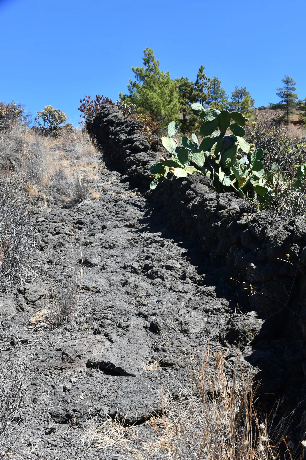
Leaving Mount Talpino behind, the dirt track transforms into a mule track, adding a touch of challenge to the trail. Known as a “herradura” path, it was historically designed, built, and used for the passage of hooved animals—horses, mules, and, in the case of El Hierro, primarily donkeys. These animals were commonly seen across much of the island until just a few decades ago, playing an essential role in easing the harsh life of many men and women in the rural communities of El Hierro. This is especially true for the people of El Pinar, whose history has been closely linked to pastoralism, as well as agriculture, forming the backbone of their livelihood and survival.
Datos Técnicos
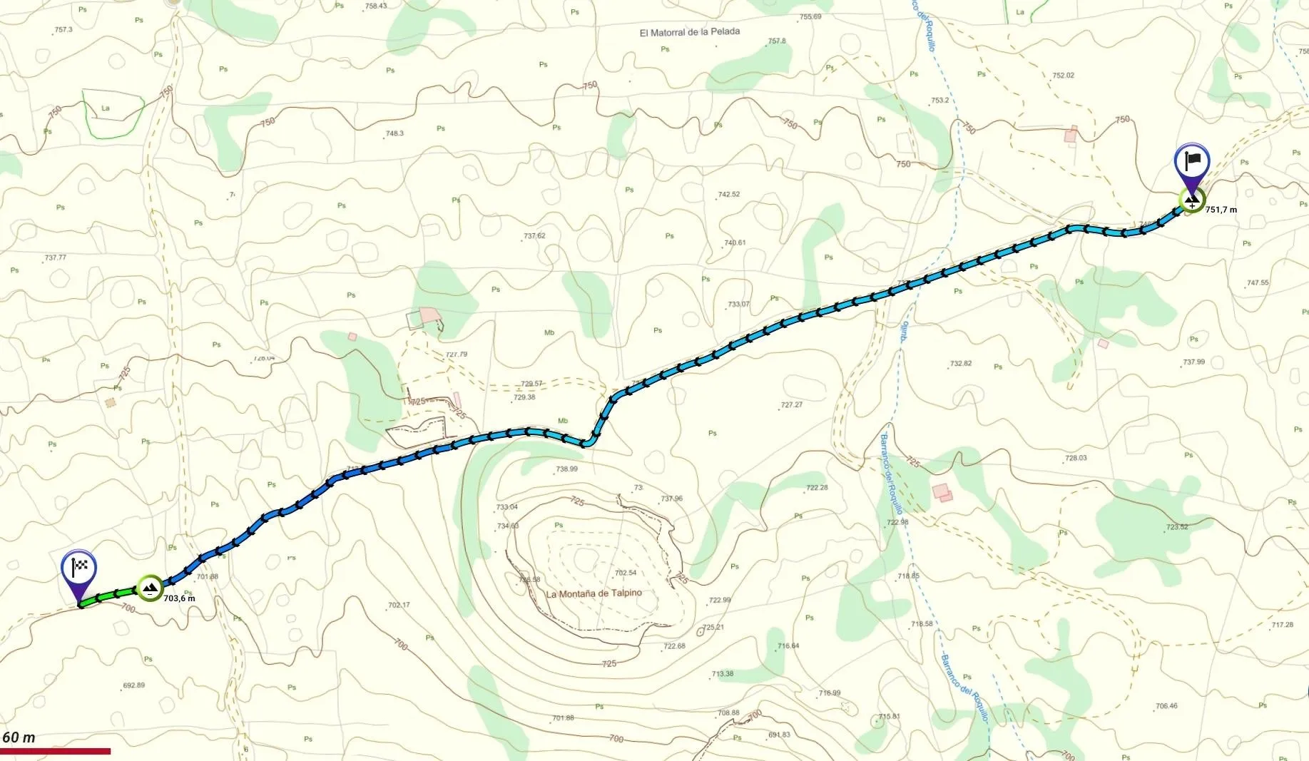
| Branch | Ramal 1 |
|---|---|
| Coordinates | 27.693656, -17.995910 |
| Maximum altitude | 751 m |
| Minimum altitude | 703 m |
| Distance (Descending) | 0,61 km |
| Duration | 11min 33s |
Pole Location
View the exact location of the pole