R4_P2
Detailed pole information
This pole is part of the trail El Mentidero - El Canto - El Cascajo in the Ramal 4. A strategic point of the route that will help you orient yourself during your journey.
Pole Details
All technical information of the point
Description
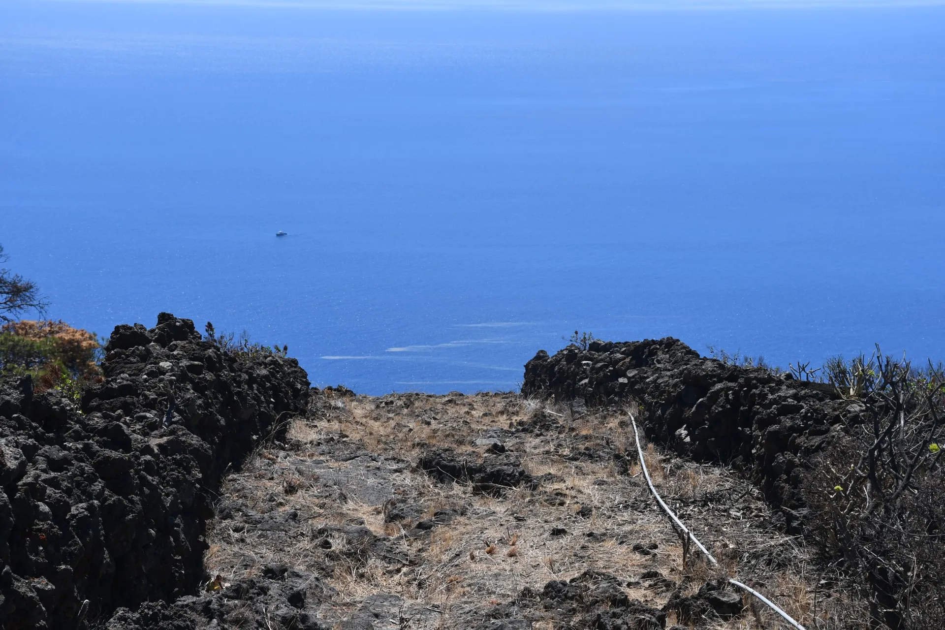
The descending, southward trajectory of this final section of the branch, where the slope becomes noticeably steeper, highlights the vast expanse of the deep blue Las Calmas Sea. From this vantage point, hikers are afforded a privileged view of artisanal fishing boats at work and, occasionally, the natural spectacle of brown algae washing ashore —carried by ocean currents from tropical regions to the island’s coast.
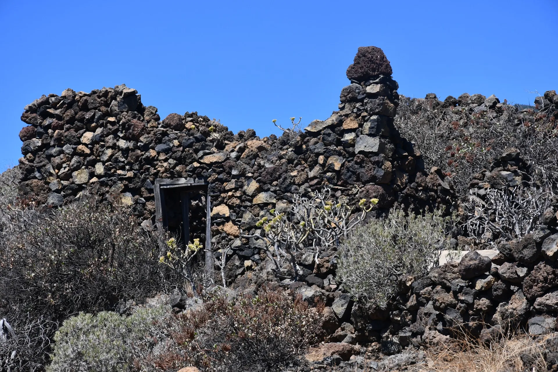
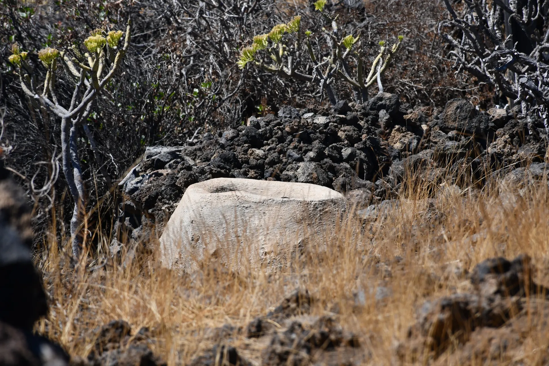
In addition, both at the start of this section and about 50 meters from its end along the Cascajo dirt track (where Branch 2 of the trail begins), it is possible to observe the ruins of old traditional houses. These shelters once provided refuge for shepherds and offer a glimpse into the austere and isolated conditions in which they lived.
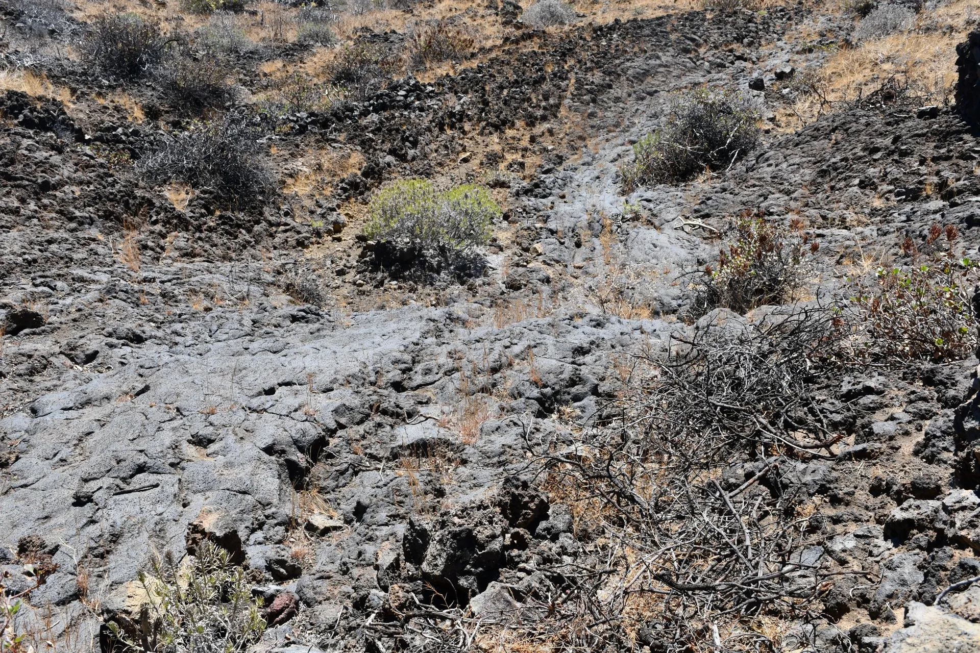
In such a remote location, access to a nearby water source was essential for both people and the animals they tended. It was not until the 19th century, with the arrival of lime on the island, that cisterns (aljibes) —like those still found at these houses— could be waterproofed to collect and store rainwater. Even a small washhouse, made using the same lime, represented the greatest luxury they could afford. Prior to that, survival in this area required making do with water collected in temporary pools forming on the lava flows, under much harsher conditions.
Upon completing this section, you will have successfully finished the branch we call “The Path of Austerity”. Congratulations!
Datos Técnicos
| Branch | Ramal 4 |
|---|---|
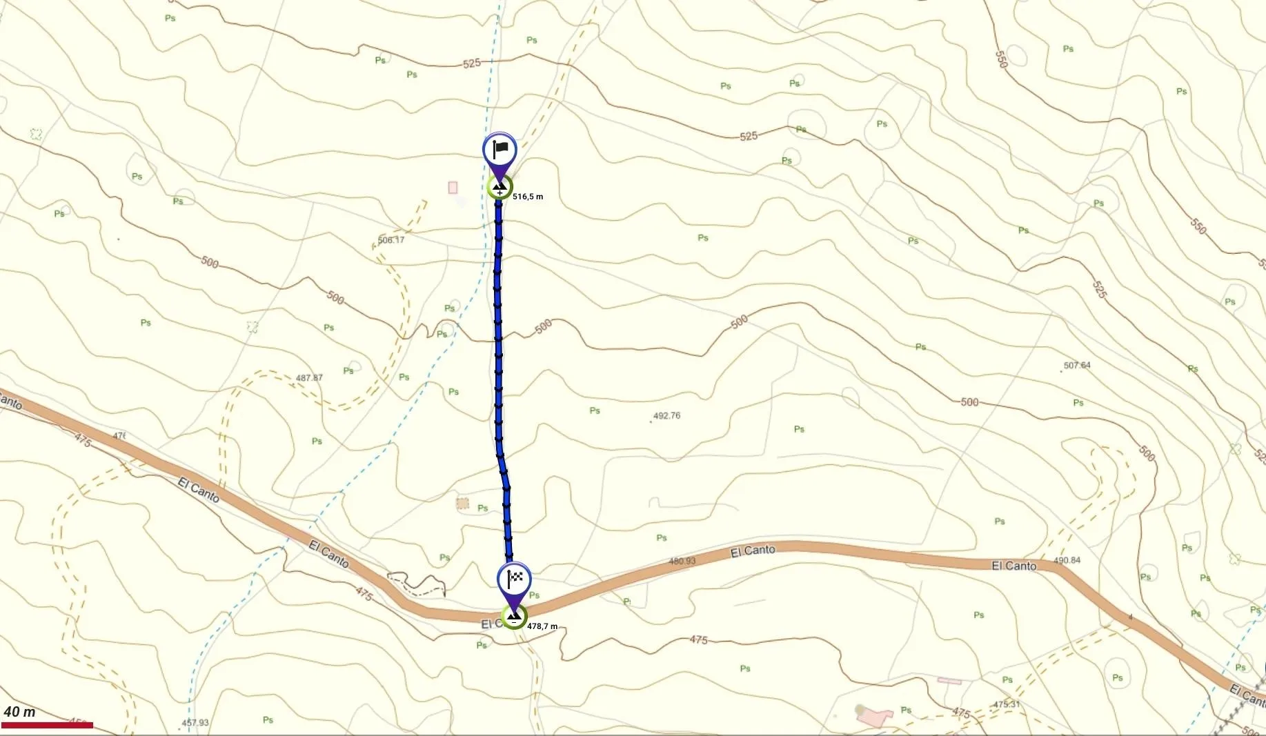
| Coordinates | 27.685999, -18.012688 |
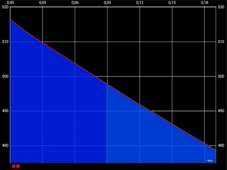
| Maximum altitude | 516 m |
| Minimum altitude | 478 m |
| Distance (Descending) | 0,19 km |
| Duration | 3min 15s |
Pole Location
View the exact location of the pole