R2_P1-P2
Detailed pole information
This pole is part of the trail El Mentidero - El Canto - El Cascajo in the Ramal 2. A strategic point of the route that will help you orient yourself during your journey.
Pole Details
All technical information of the point
Description
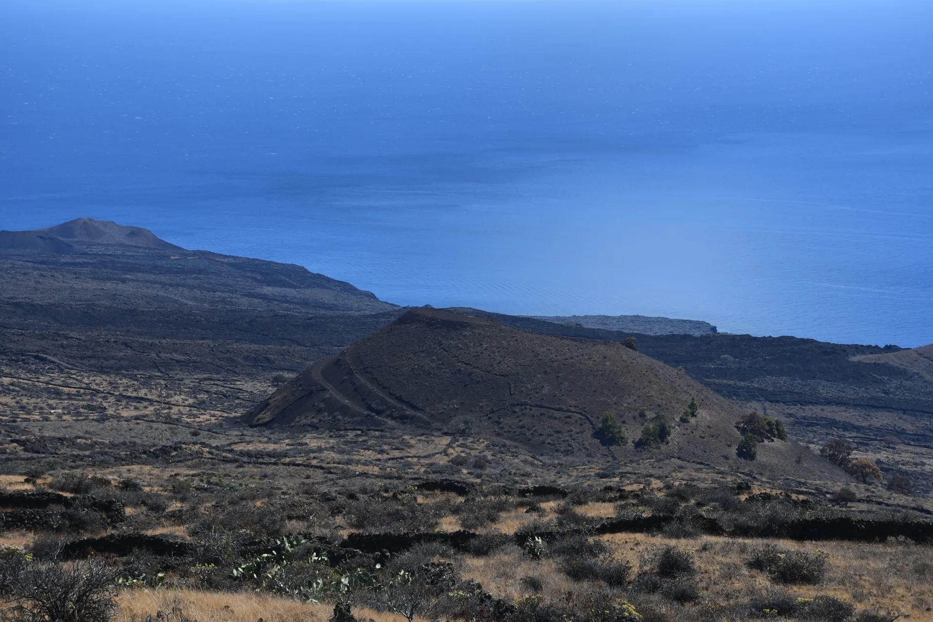
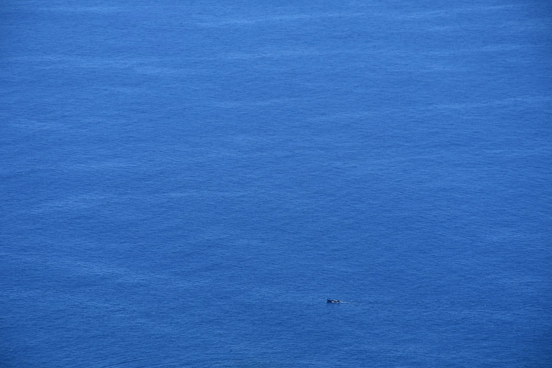
The starting point of the first stretch of this branch coincides with the end of Branch 4. The trail runs along the southern slopes of Mount La Cueva and the El Canto dirt track, ascending toward the vicinity of Mount Los Corrales de Las Cabras. To the south, Mount Quemada can be seen —a volcanic crater whose flattened summit is the result of historical human intervention for aggregate extraction.
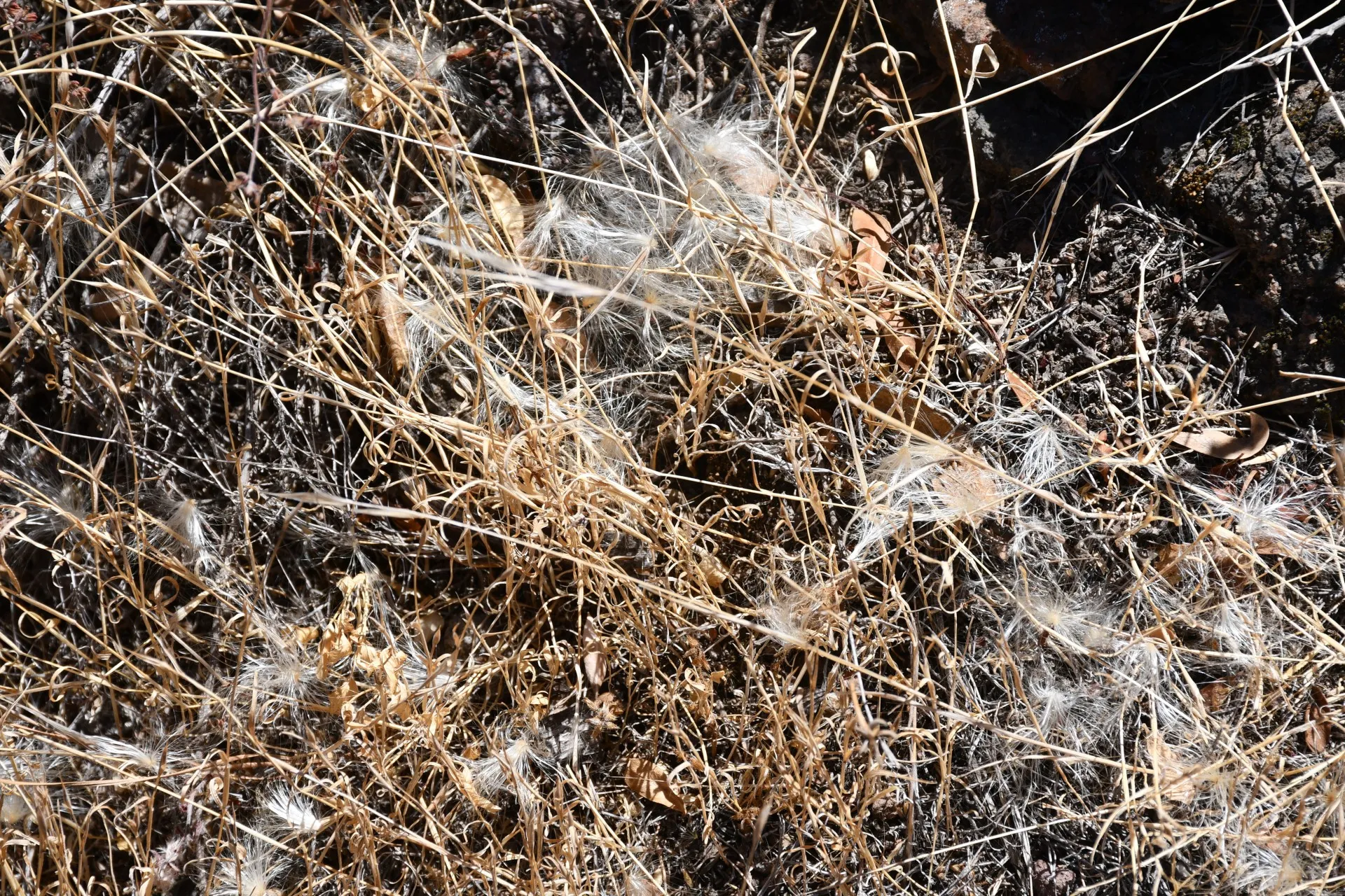
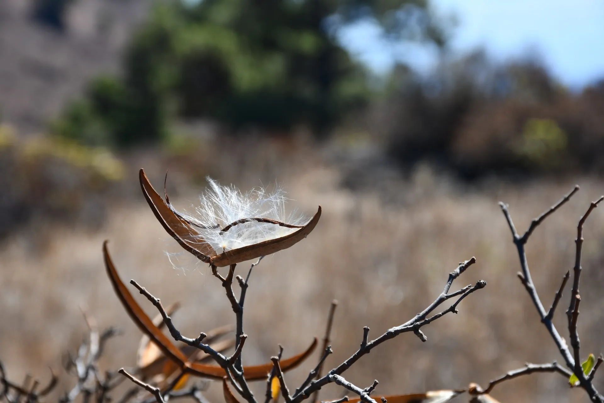
Along this stretch, as well as throughout the rest of this branch, hikers can observe how these landscapes —and the diverse, fragile natural resources they contain— have been used in different ways over time. Some resources continue to be exploited today in a sustainable and environmentally respectful manner, such as fishing in the Sea of Las Calmas. Others, like the harvesting of seed fluff from "cornicales" (Periploca laevigata) to stuff pillows, have completely disappeared. By late summer, however, it is still possible to see the white mats formed by accumulated seed fluff on the ground in certain areas.
At the same time, the scrub from which this fluff comes may still be used as forage, at particular times of year and alongside many other local species, maintaining a degree of pastoral activity. Despite modernity and various challenges, this traditional use has resisted disappearance, in a place where livestock grazing was once a primary means of livelihood.
Datos Técnicos
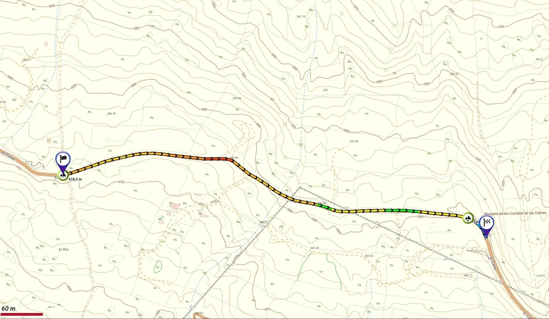
| Branch | Ramal 2 |
|---|---|
| Coordinates | 27.684286, -18.012650 |
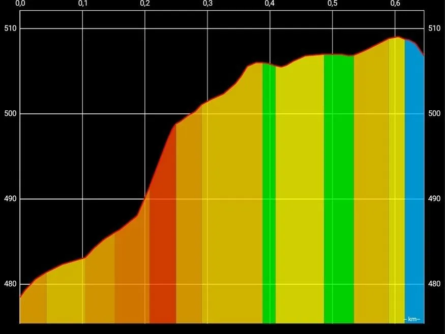
| Maximum altitude | 509 m |
| Minimum altitude | 478 m |
| Distance (Ascending) | 0,56 km |
| Duration | 11min 6s |
Pole Location
View the exact location of the pole