R1_P7-P8
Detailed pole information
This pole is part of the trail El Mentidero - El Canto - El Cascajo in the Ramal 1. A strategic point of the route that will help you orient yourself during your journey.
Pole Details
All technical information of the point

Description
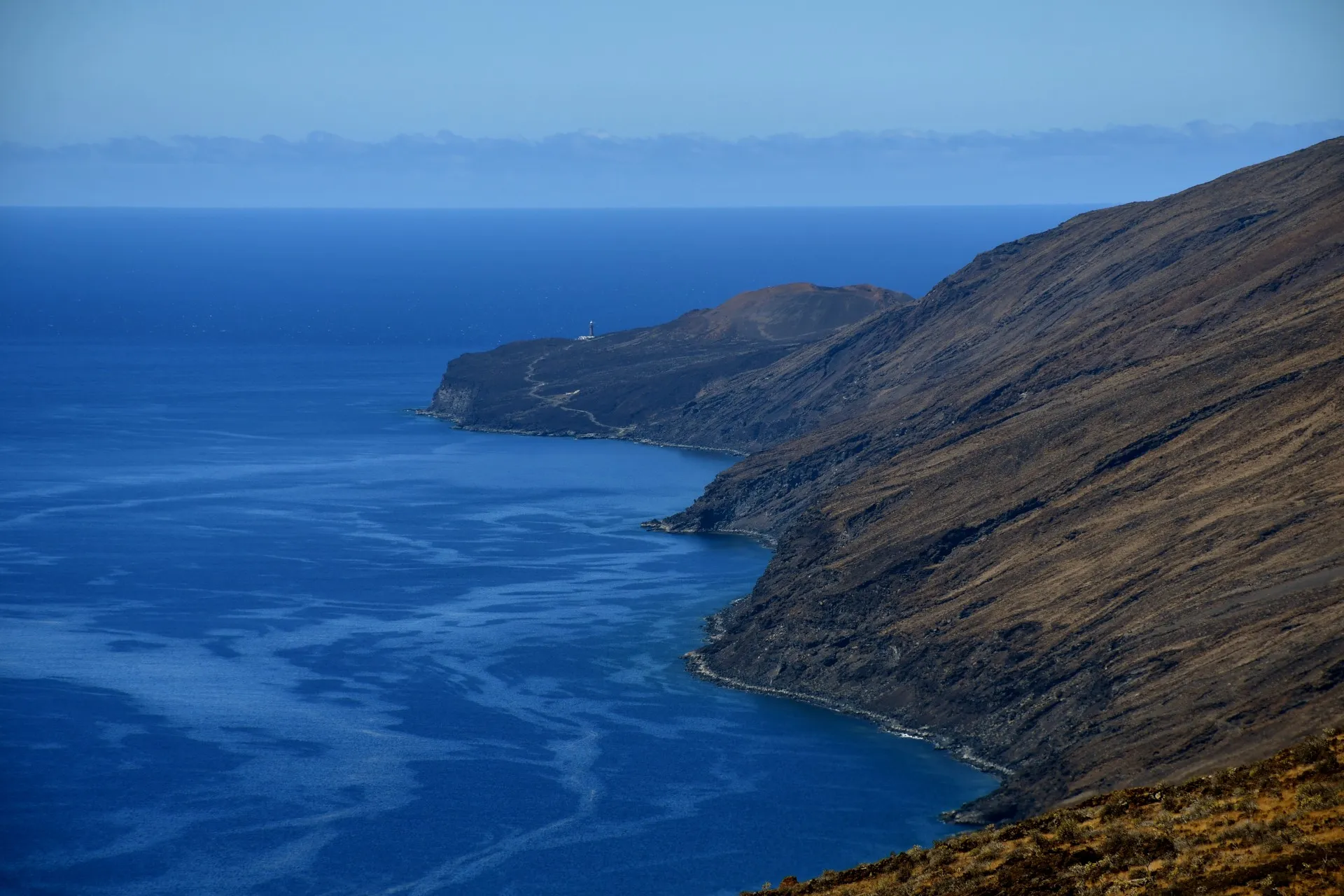
In this final section of the branch, the path initially heads westward, allowing hikers to catch their first glimpses, in the distance, of the slopes of El Julan and the Orchilla Lighthouse. For a long time —and before the discovery of America— this lighthouse marked what was considered the westernmost point of the known world, the “end of the earth”, and the last landmark seen by sailors who dared to venture into uncharted waters.
In more recent historical times, the lighthouse retained its symbolic significance as the final piece of homeland disappearing from view for the many people from the island of El Hierro who were forced to embark on sailing ships bound for the American continent in search of new opportunities and better living conditions.
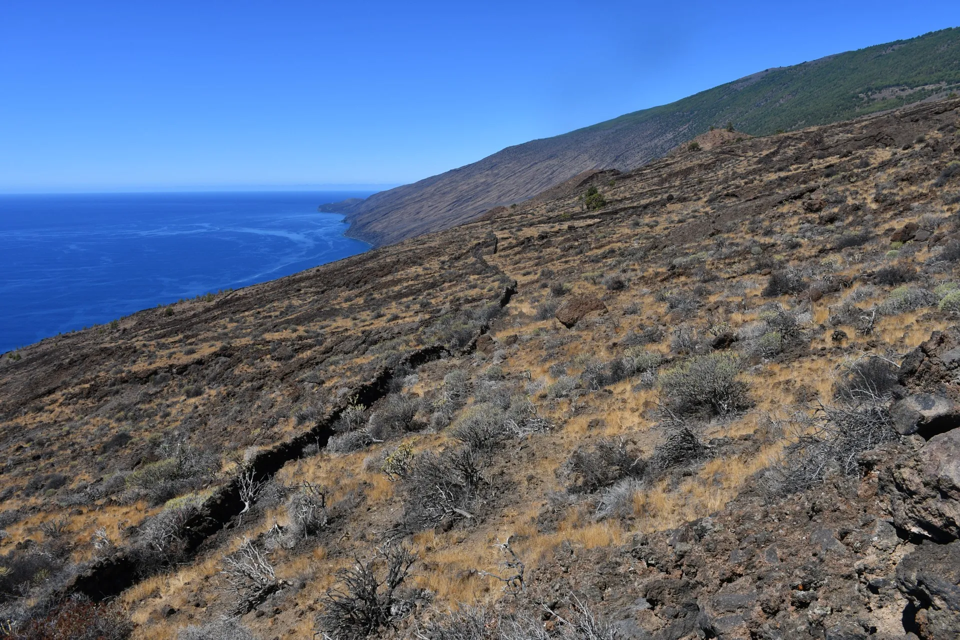
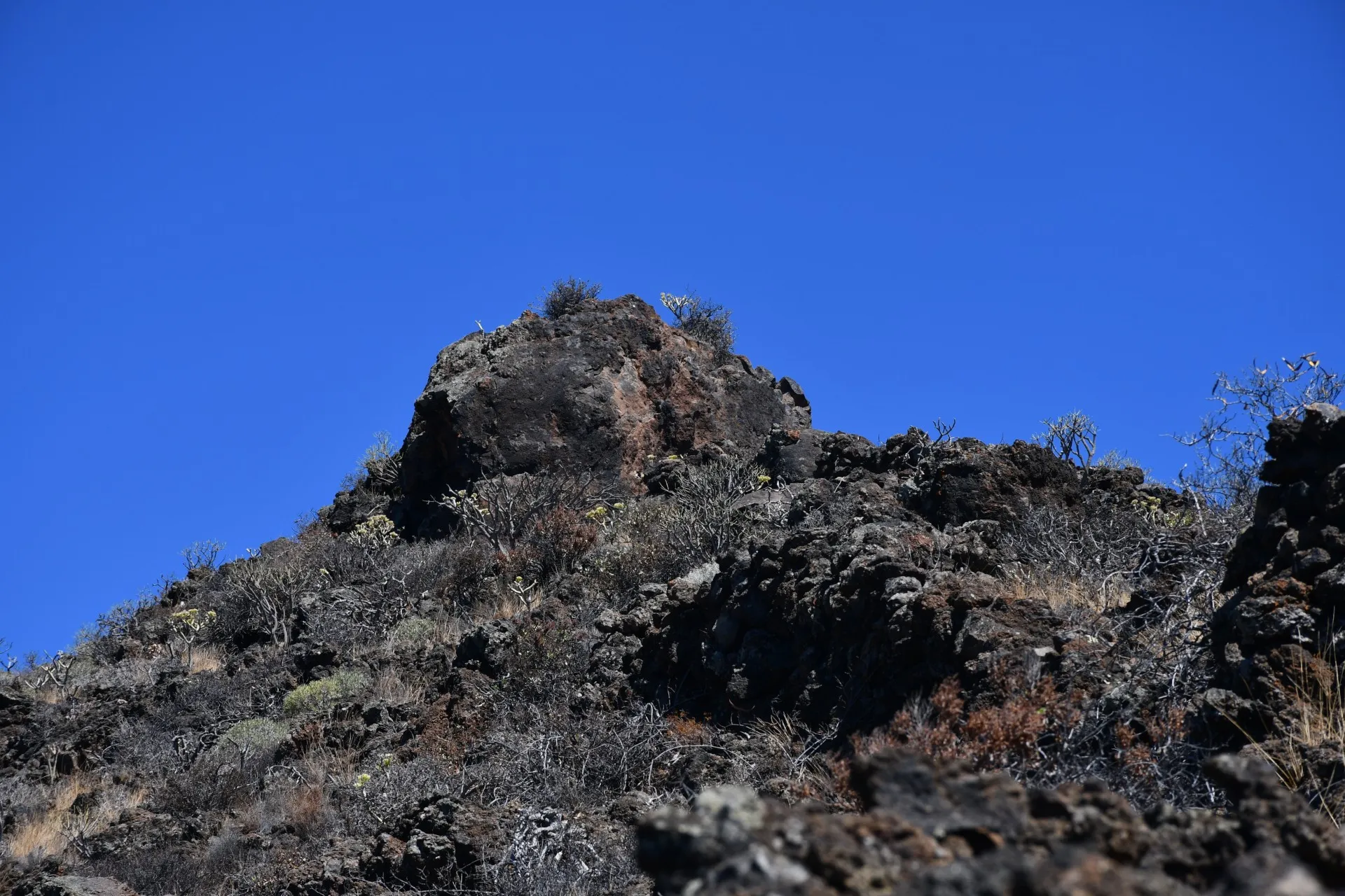
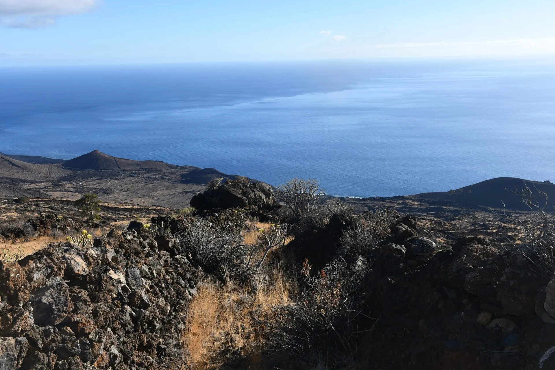
About 450 metres from the beginning of this section, the route changes direction and follows the steepest gradient of the slope, turning southwards. From this point, the vastness of the Mar de Las Calmas unfolds before the traveller, stretching away until it vanishes into the horizon. Nearing the end of the path, at El Canto Rock —a huge volcanic bomb carried across the surface by the lava flow in which it now lies— one can clearly observe, above that sea, the diffuse line dividing the turbulent waters from those that remain calm and sheltered from the trade winds, which are unable to cross the island’s south-western ridge.
Along the coast, close to that dividing line and within the calm zone, lies the place known as Tacorón: a small cove with natural pools where visitors can enjoy sea bathing all year round, thanks to an average air temperature of around 22 °C and a minimum winter water temperature of about 20 °C.
Datos Técnicos
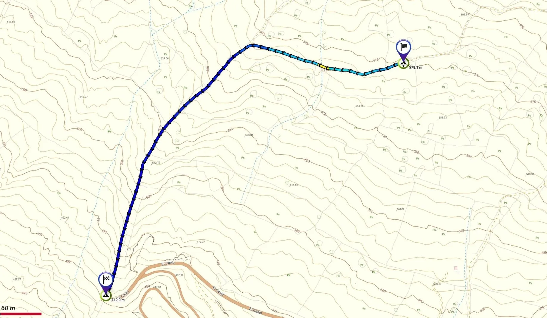
| Branch | Ramal 1 |
|---|---|
| Coordinates | 27.688720, -18.013679 |
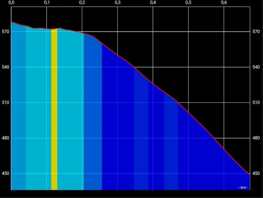
| Maximum altitude | 578 m |
| Minimum altitude | 449 m |
| Distance (Descending) | 0,67 km |
| Duration | 11min 33s |
Pole Location
View the exact location of the pole