R2_P7-P8
Detailed pole information
This pole is part of the trail El Mentidero - El Canto - El Cascajo in the Ramal 2. A strategic point of the route that will help you orient yourself during your journey.
Pole Details
All technical information of the point
Description
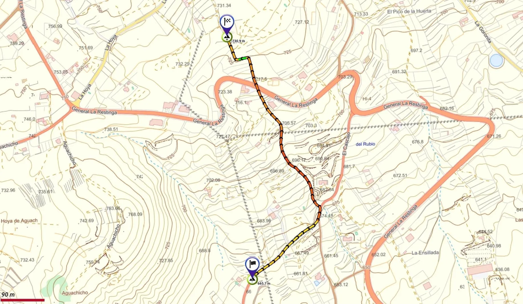
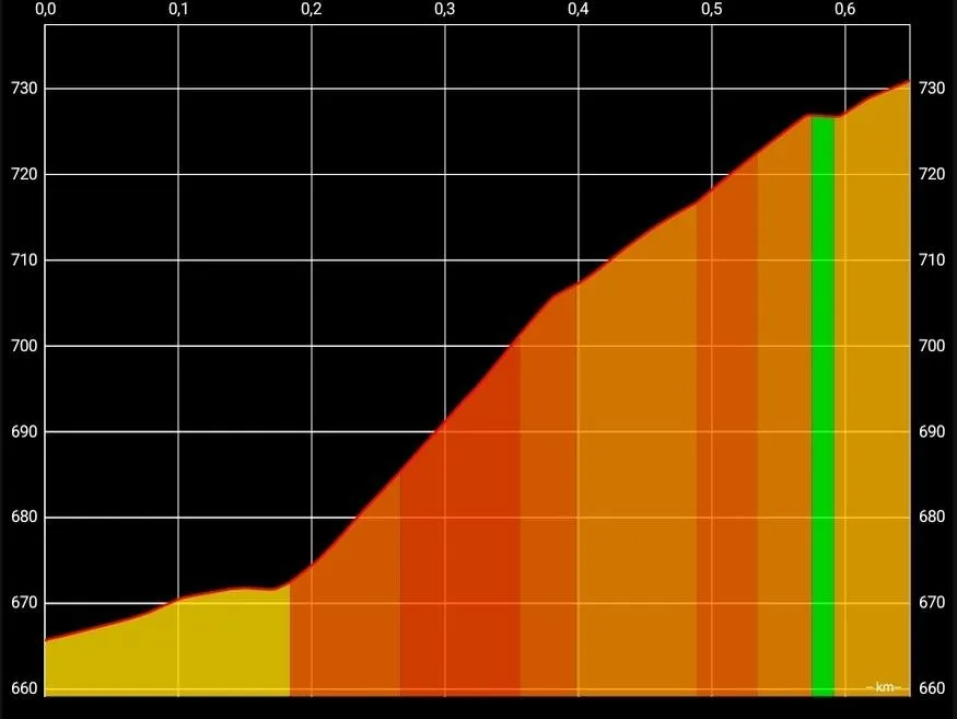
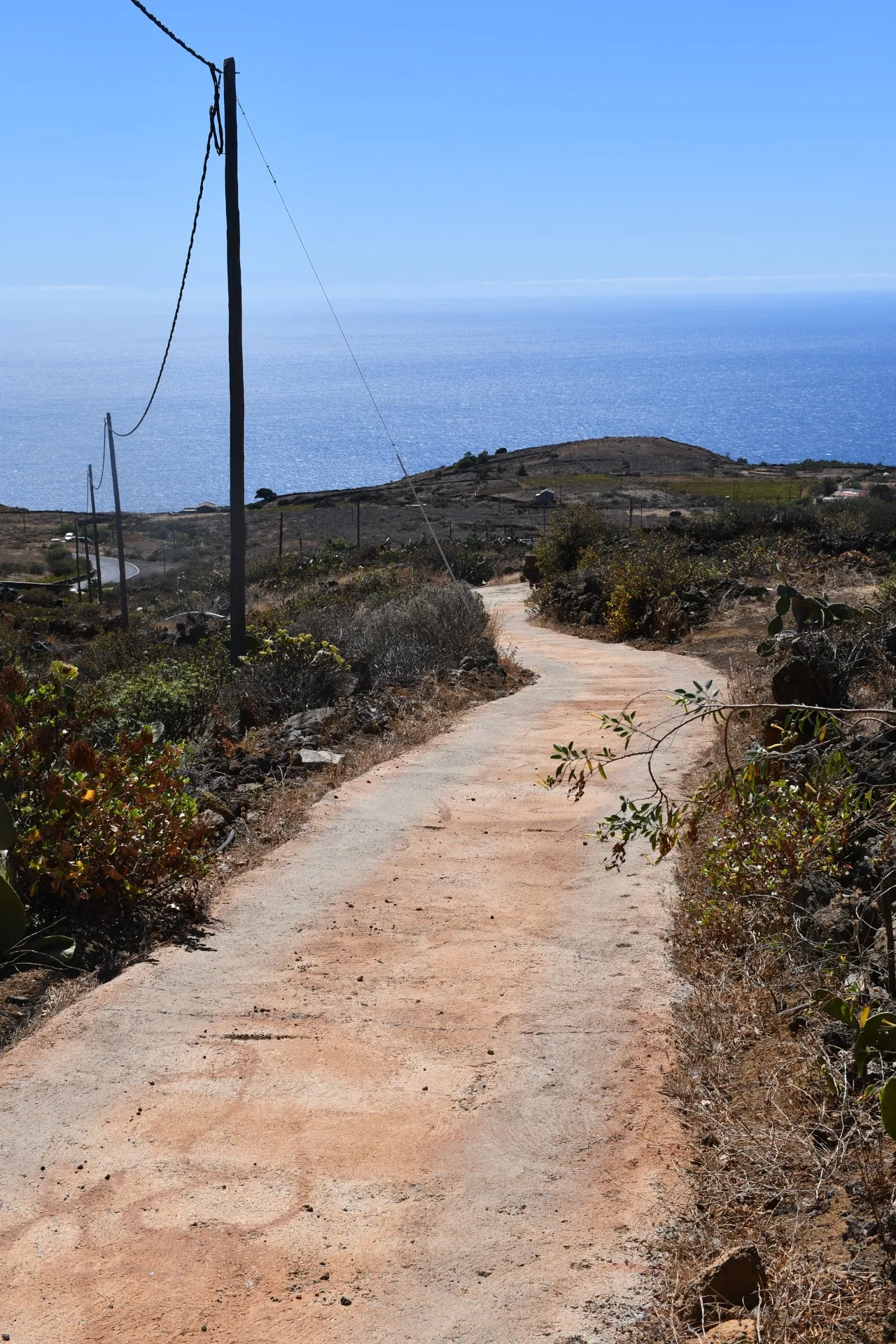
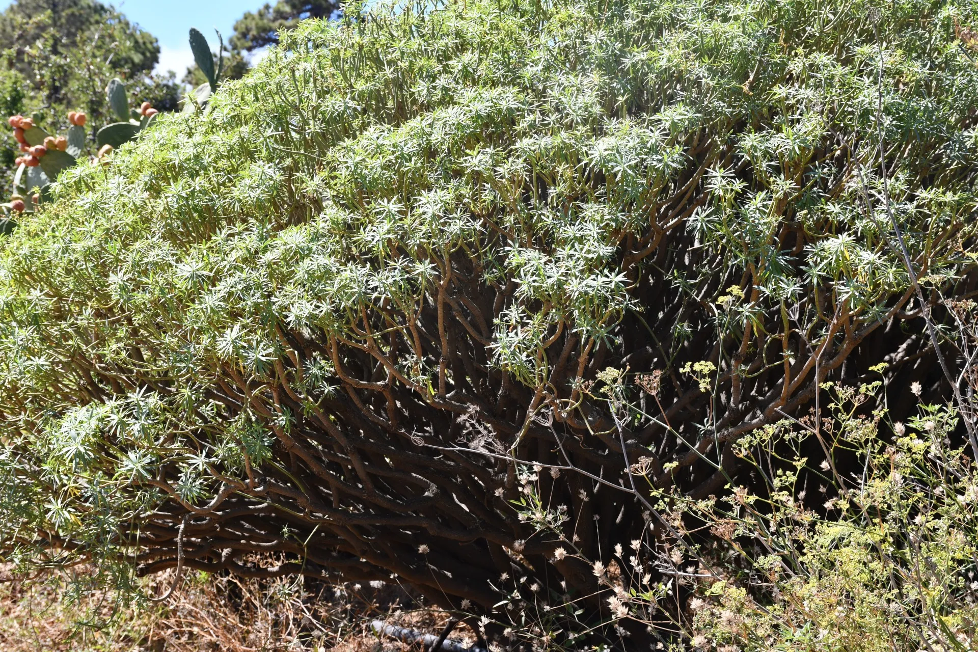
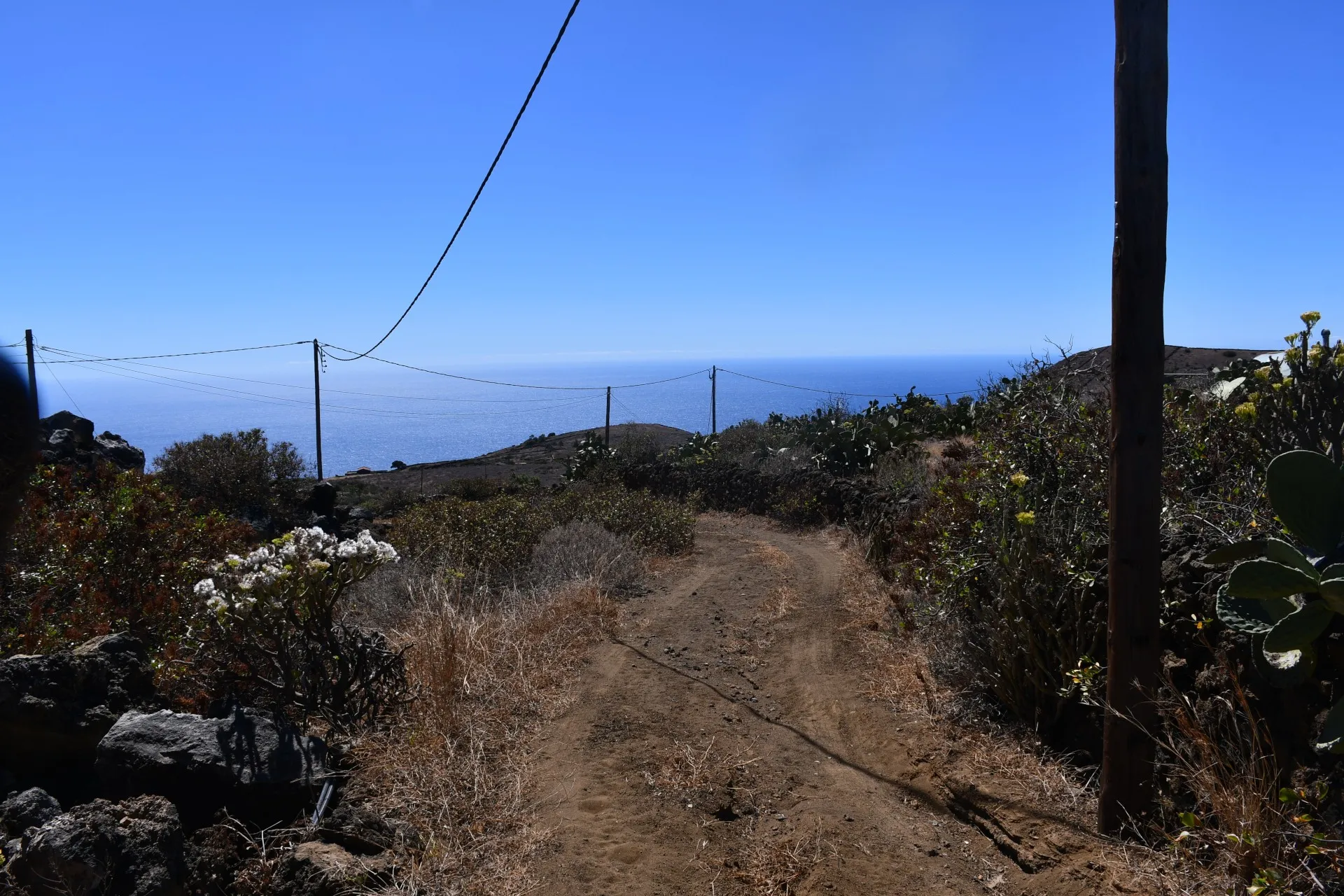
From this point, the trail continues ascending northeast along the same paved track used in the previous two sections. Upon reaching Era del Barranco, hikers must change direction, leaving the paved track behind and heading northwest along a dirt path, which further ahead becomes a cement track. Before reaching the end of this stretch, it is necessary to cross the Carretera General de La Restinga along a straight section with good visibility. From Era del Barranco, the path becomes somewhat steep and enclosed, limiting the views. It is therefore recommended to take this stretch at a relaxed pace, allowing time to observe and admire the various wild plants and bird species encountered along the way. Among these plants, hikers may get a close look at some remarkable individuals of wild "tabaiba" (Euphorbia lamarkii) growing along the path edges.
Because this species is almost constantly present along the trail, it may not have drawn particular attention until now. However, it is a plant with the distinctive property of excreting a white, toxic latex when its branches are broken or leaves removed, which can irritate the eyes upon contact.
Historically, it had multiple uses, such as catching octopuses (Octopus vulgaris) and fish like mullets (Chelon labrosus) in intertidal pools. Branches or pieces of the plant were submerged in the pools, and the sap would flush octopuses from their shelters or stupefy mullets, making them easy to catch by hand. The latex was also used to make a sticky substance called liria , employed to capture birds by making them stick to it.
Datos Técnicos
| Branch | Ramal 2 |
|---|---|
| Coordinates | 27.692387, -17.981140 |
| Maximum altitude | 730 m |
| Minimum altitude | 665 m |
| Distance (Ascending) | 0,65 km |
| Duration | 11min 6s |
Pole Location
View the exact location of the pole