R3_P2-P3
Detailed pole information
This pole is part of the trail El Mentidero - El Canto - El Cascajo in the Ramal 3. A strategic point of the route that will help you orient yourself during your journey.
Pole Details
All technical information of the point
Description
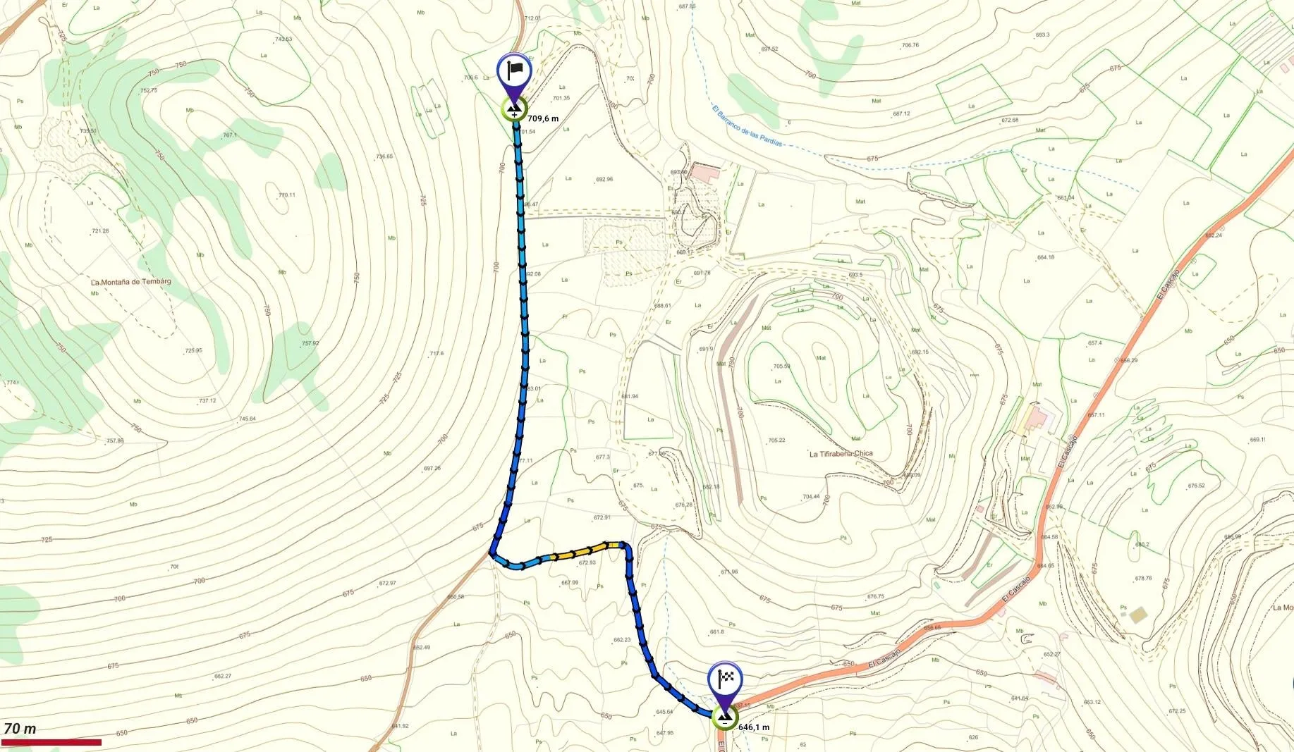
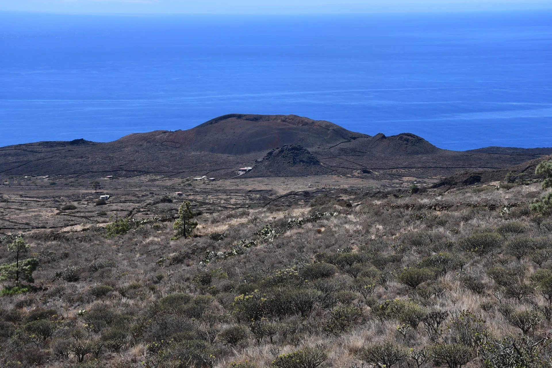
This second and final section of Branch 3 begins near Las Pardías Ravine and heads south, skirting the eastern slopes of Montaña (Volcano) Tembárgena along a dirt track toward Tifirabena Chica. Further ahead, a signposted junction marks the location of an interpretive panel describing the volcanic landscape visible from that point. To continue, hikers must turn east at this junction, leaving the dirt track and following a mule track.
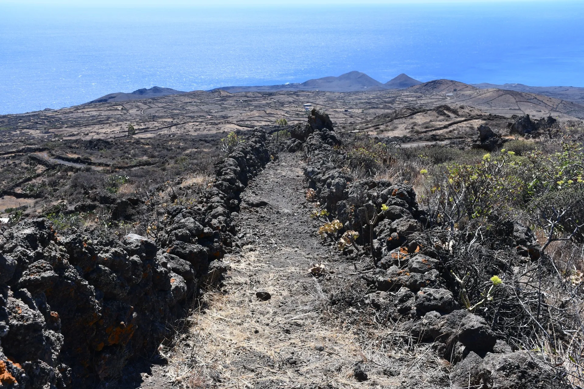
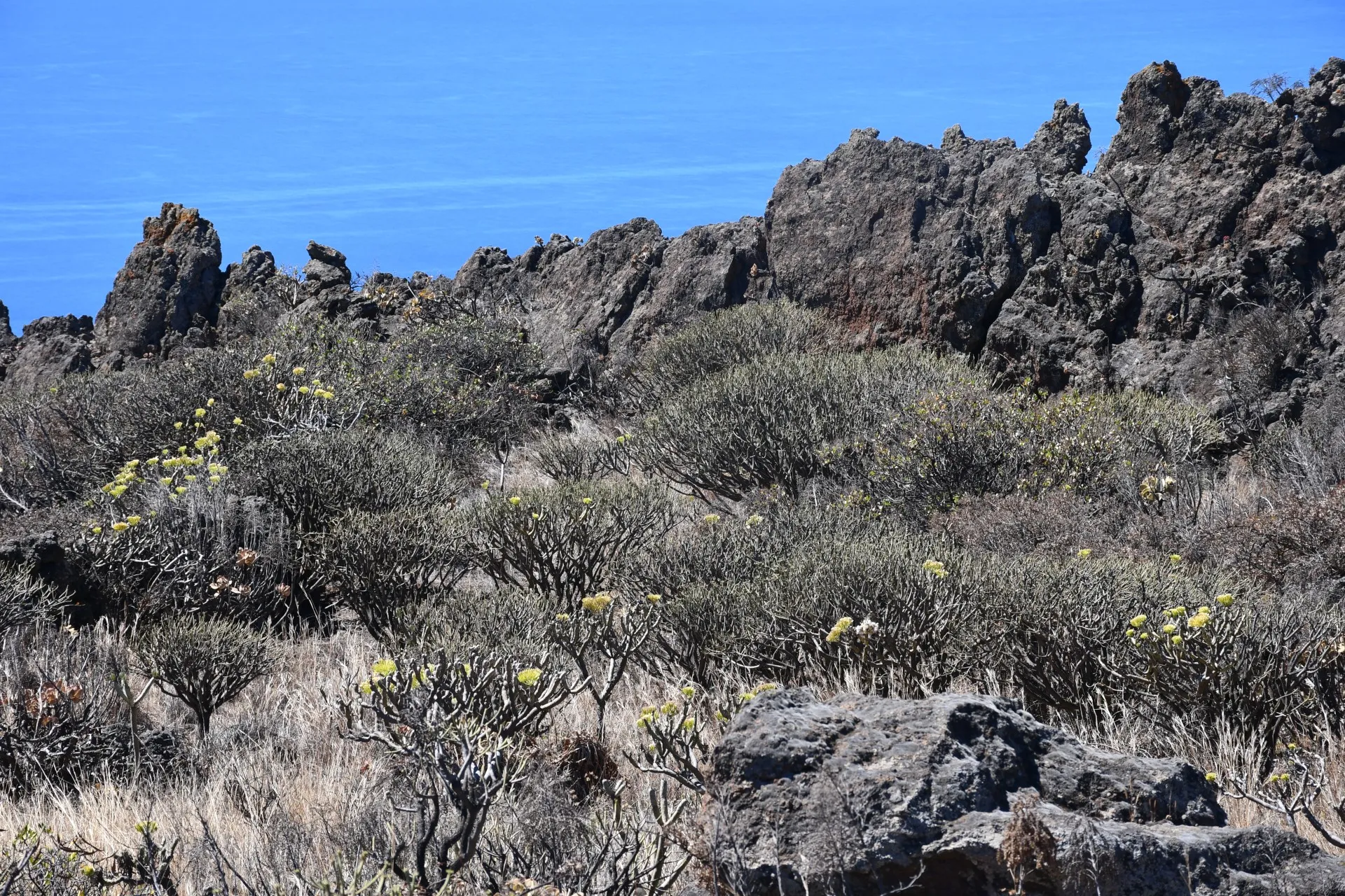
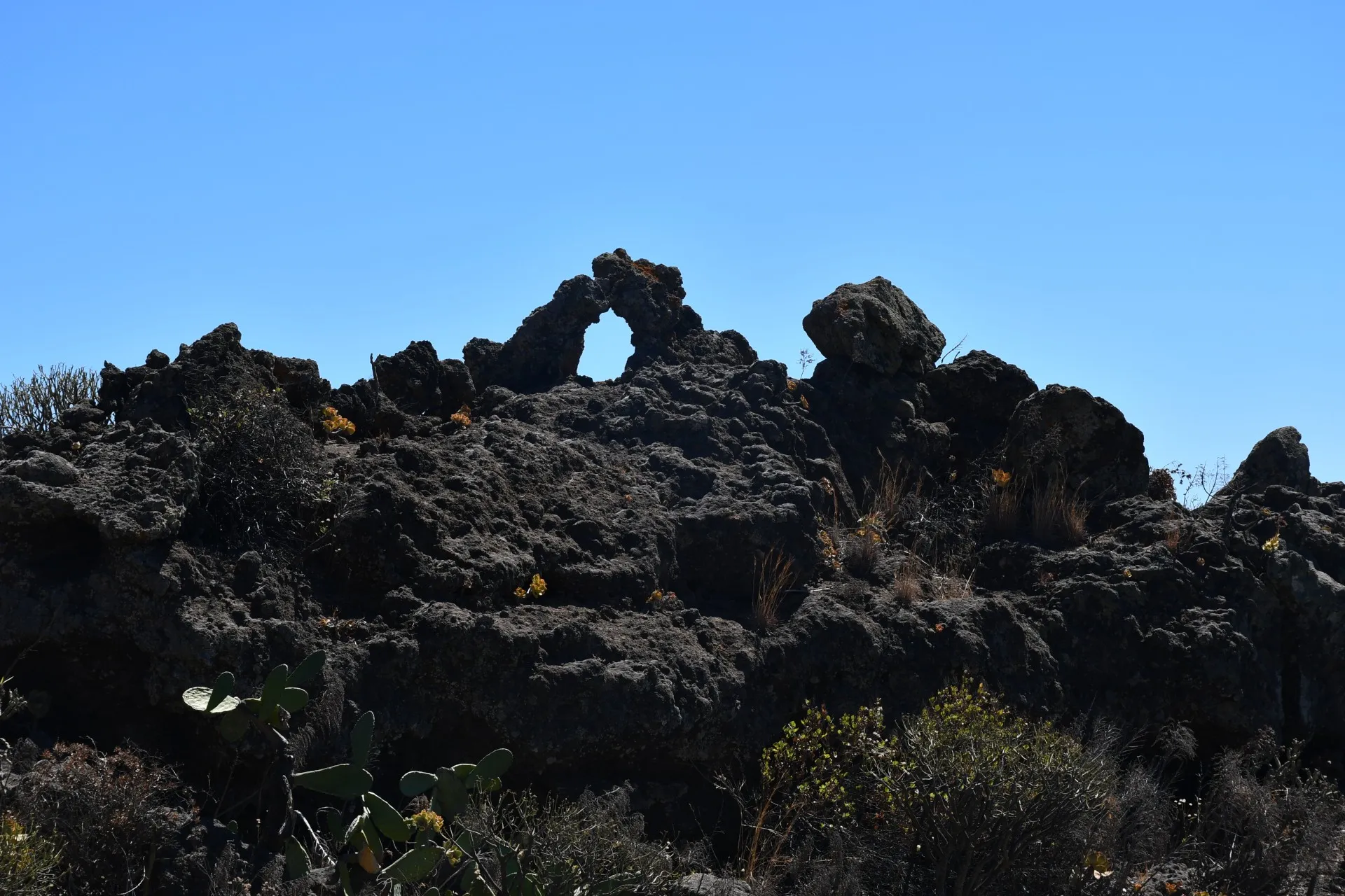
Throughout this section, the distance from the more human-altered areas—those shaped mainly by recent agricultural activity—becomes increasingly evident. As they fade into the background, the trail reveals a landscape dominated by the whimsical shapes of untouched volcanic formations and a notable regeneration of native vegetation, with the wild "tabaiba" (Euphorbia lamarkii) adding a lush green tone to the scenery.
As a stunning backdrop, the numerous volcanic craters scattered across the island’s southern tip become increasingly prominent. Their varied ochre hues stand in striking contrast with the vivid, deep blue of the sea, and their names and geological features are detailed on the interpretive panel mentioned earlier.
Datos Técnicos
| Branch | Ramal 3 |
|---|---|
| Coordinates | 27.689935, -17.988629 |
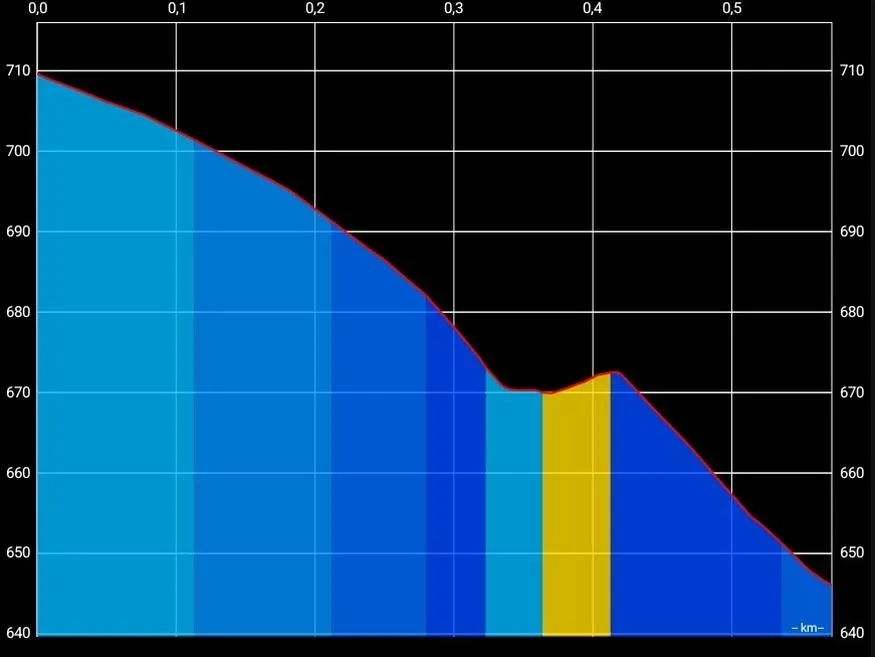
| Maximum altitude | 709 m |
| Minimum altitude | 646 m |
| Distance (Descending) | 0,57 km |
| Duration | 9min 47s |
Pole Location
View the exact location of the pole