R3_P1-P2
Detailed pole information
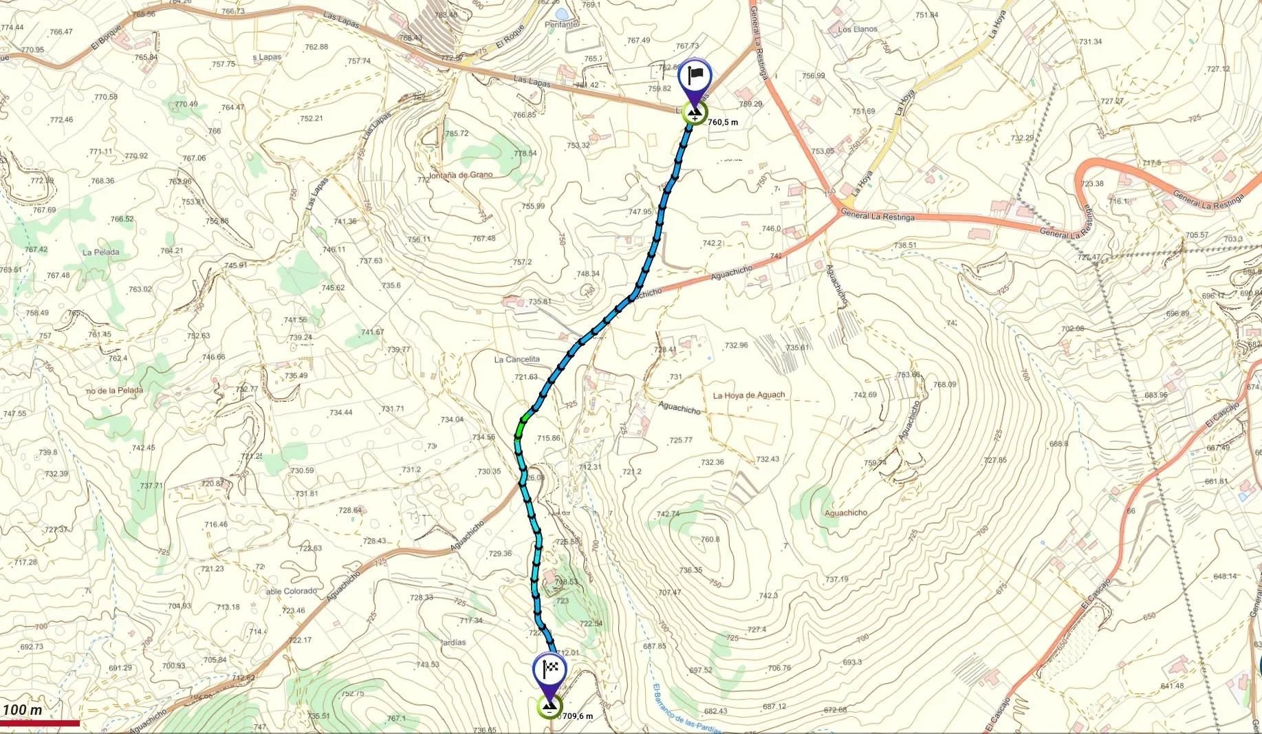
This pole is part of the trail El Mentidero - El Canto - El Cascajo in the Ramal 3. A strategic point of the route that will help you orient yourself during your journey.
Pole Details
All technical information of the point
Description
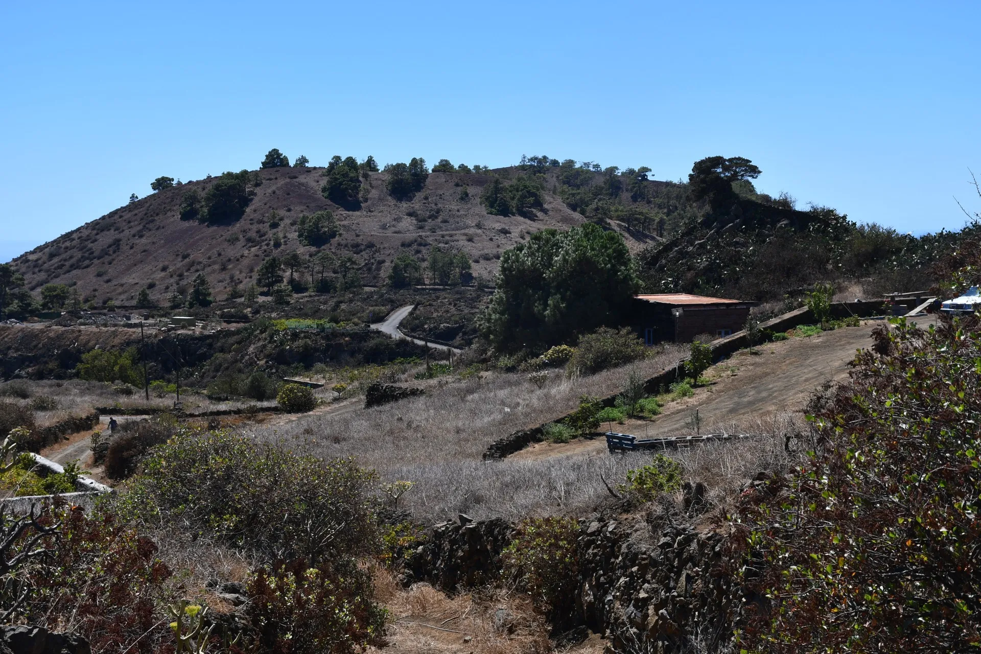
The path initially follows a marked nature trail, descending southward and ending near Las Pardías Ravine, whose current name possibly derives from a deformation of “Gaspar Díaz”.
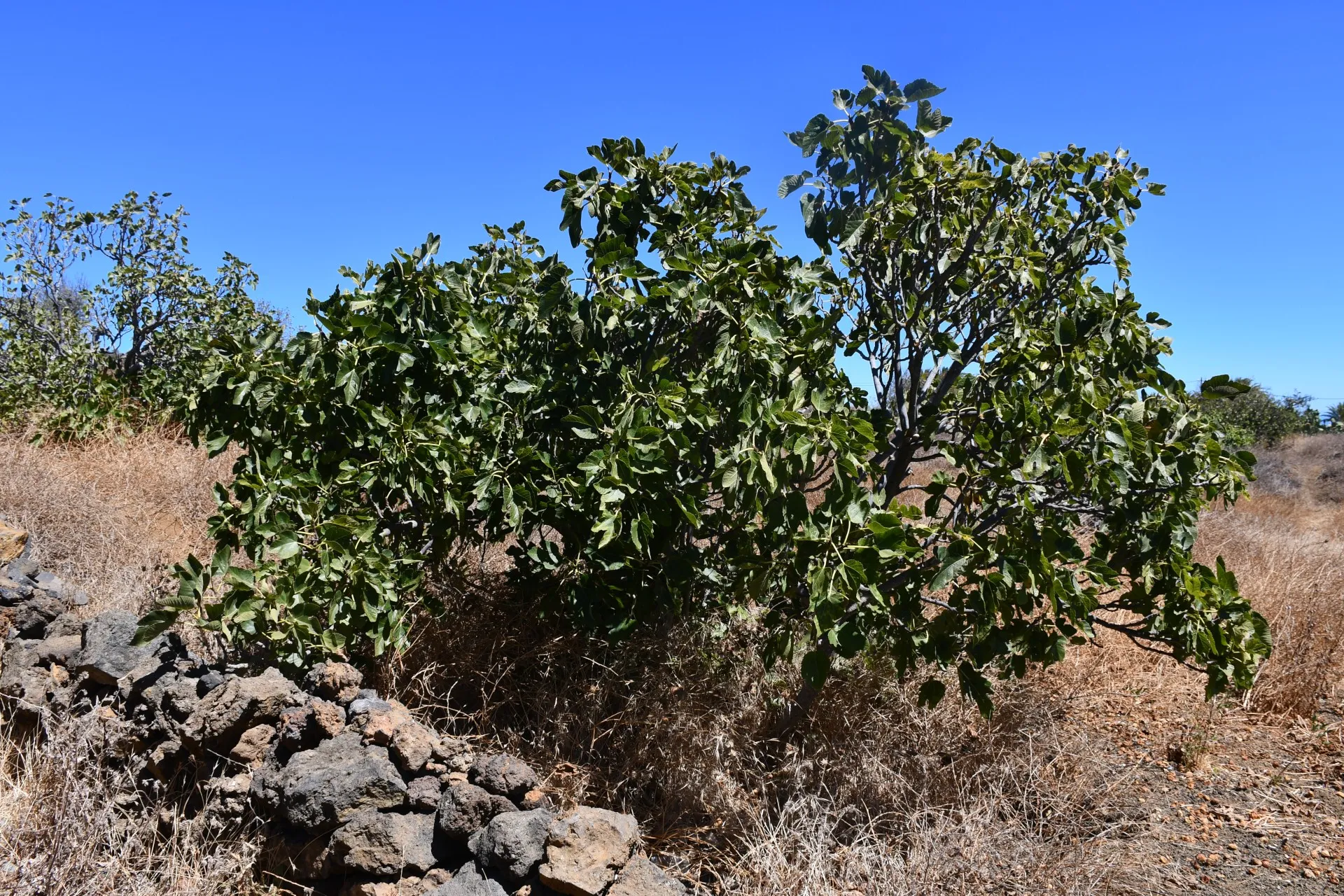
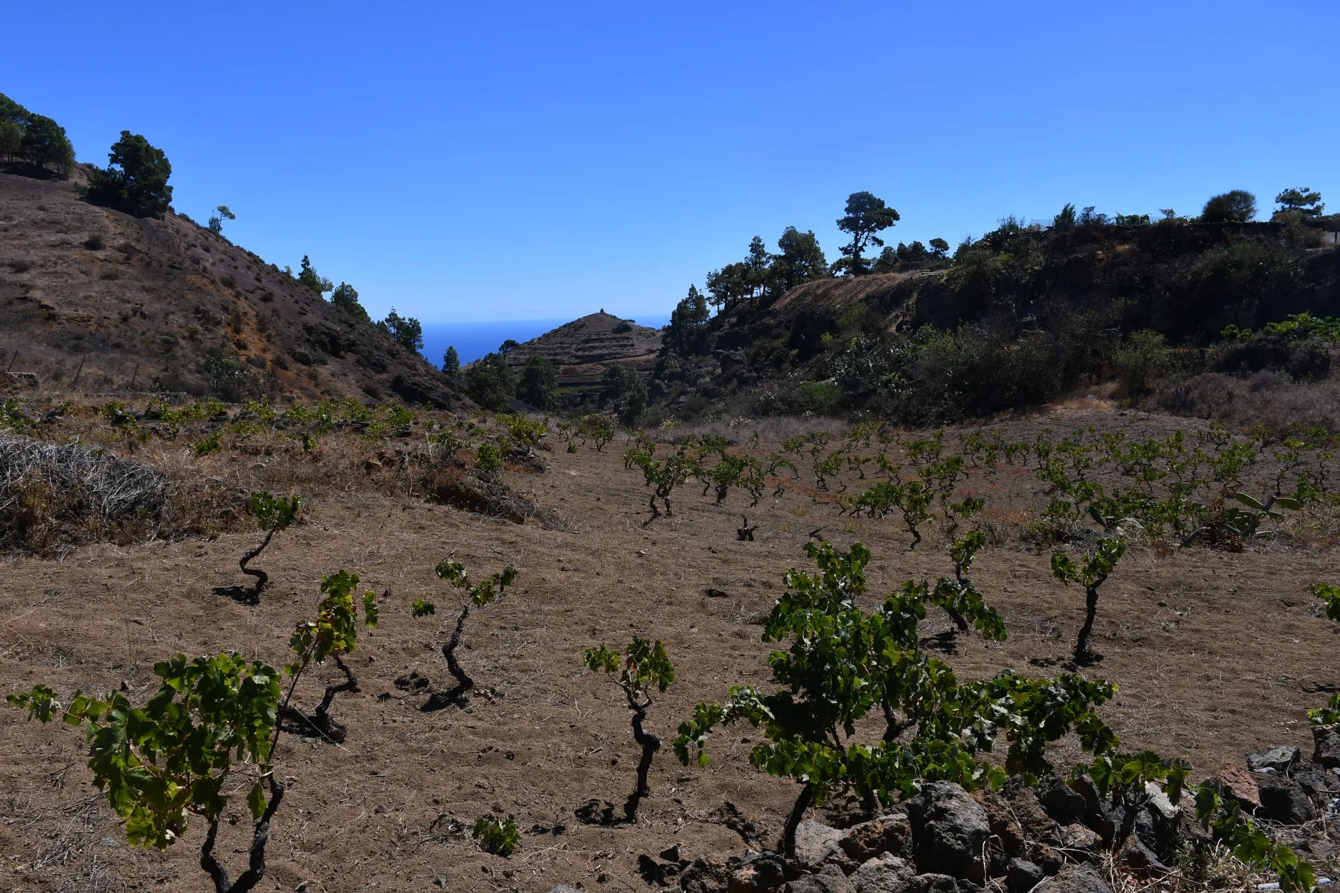
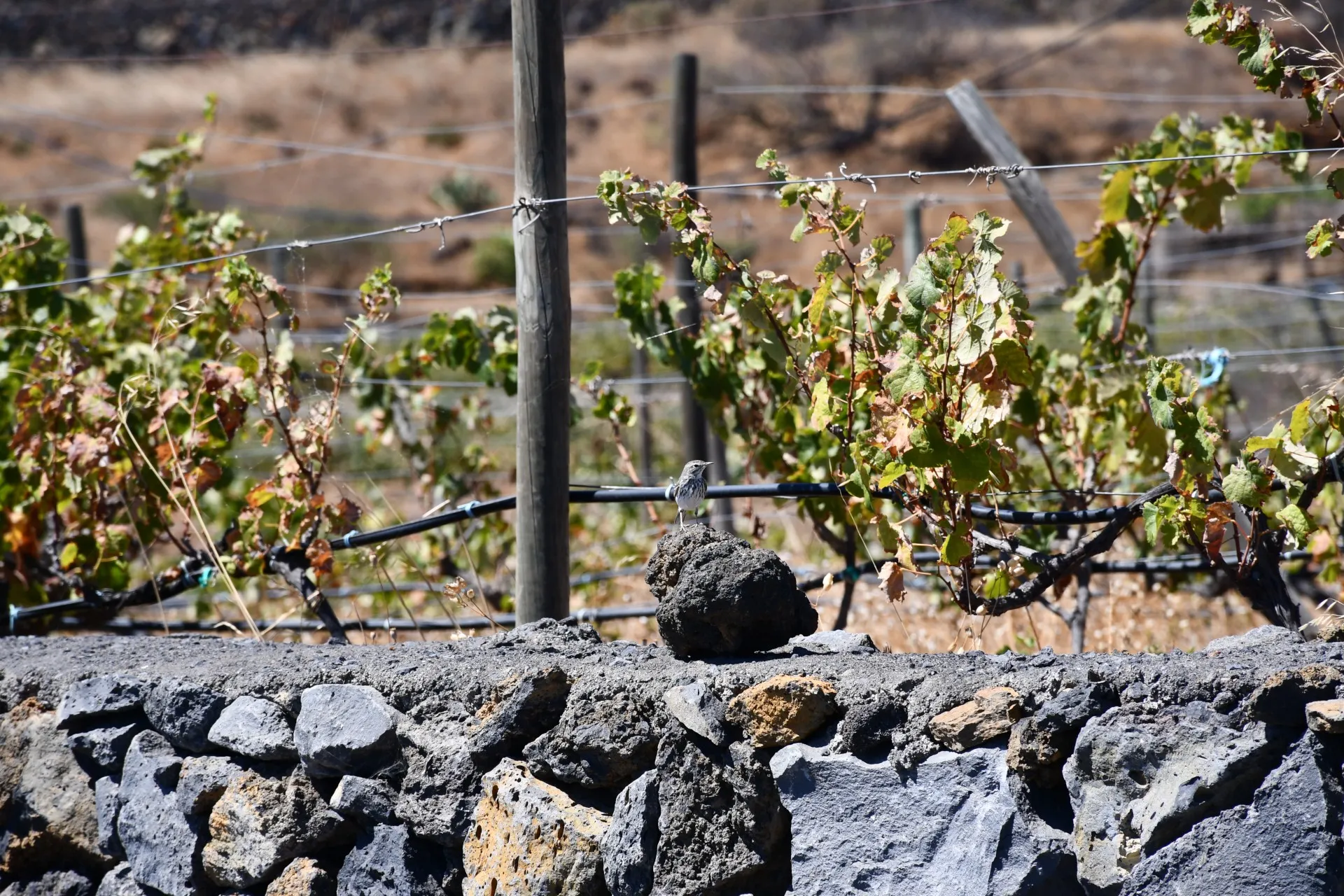
Over the first 240 meters, the route runs along a dirt track, from which hikers can spot Montaña de Grano to the east. From there, it joins a paved road for about 290 meters, bordered by small plots of vineyards (Vitis vinifera), fig trees (Ficus carica), almond trees (Prunus dulcis), and vegetable gardens, passing through the area known as La Cancelita. Along its stone walls and verges, it is common to see "camineros" (Anthus berthelotii) darting or fluttering about.
Datos Técnicos
| Branch | Ramal 3 |
|---|---|
| Coordinates | 27.696709, -17.986778 |
| Maximum altitude | 760 m |
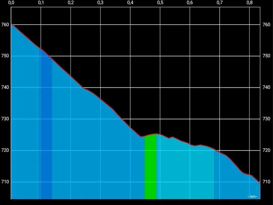
| Minimum altitude | 709 m |
| Distance (Descending) | 0,83 km |
| Duration | 14min 18s |
Pole Location
View the exact location of the pole