R1_P2-P3
Detailed pole information
This pole is part of the trail El Mentidero - El Canto - El Cascajo in the Ramal 1. A strategic point of the route that will help you orient yourself during your journey.
Pole Details
All technical information of the point
Description
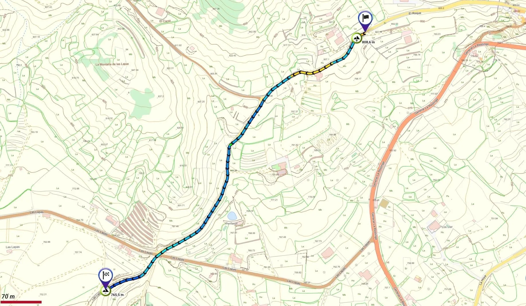
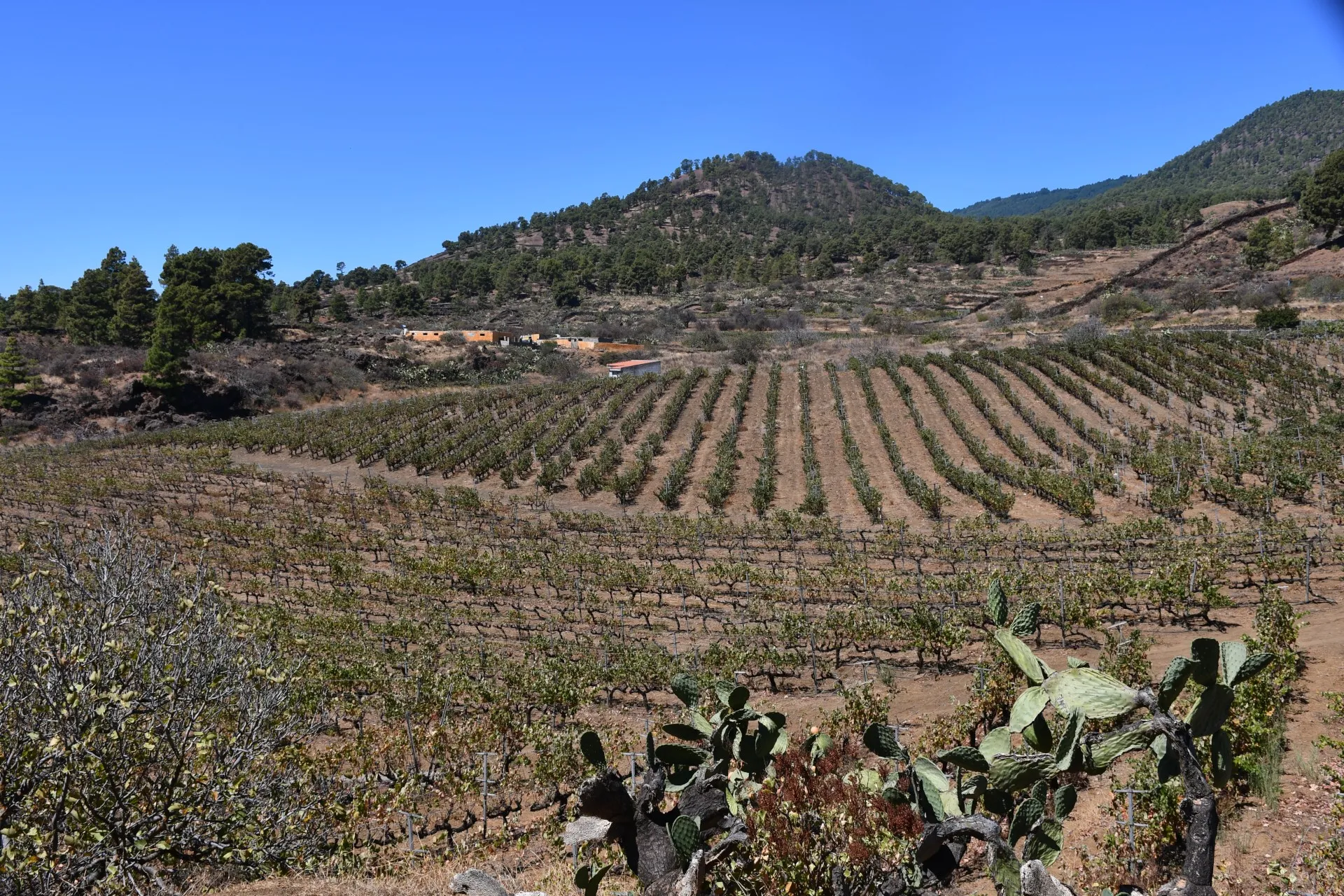
This section continues along El Roque Street (a paved track) and ends at Camino del Bérote (a concrete path). For most of the way, the route is flanked by stone walls, offering open views toward Los Llanos to the southeast and the ridge of Perifante to the west, lying on the southern slopes of Mount Perifante.
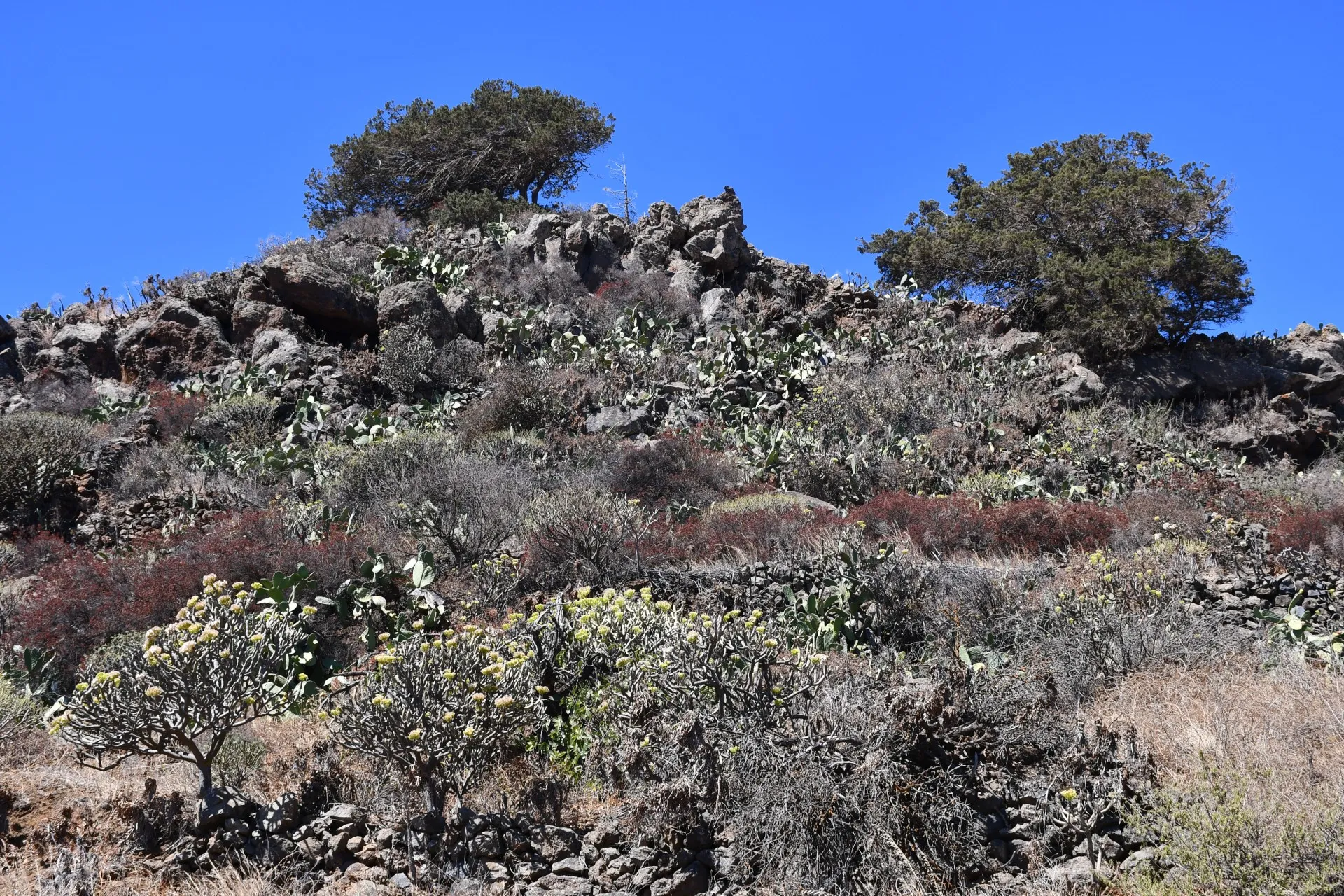
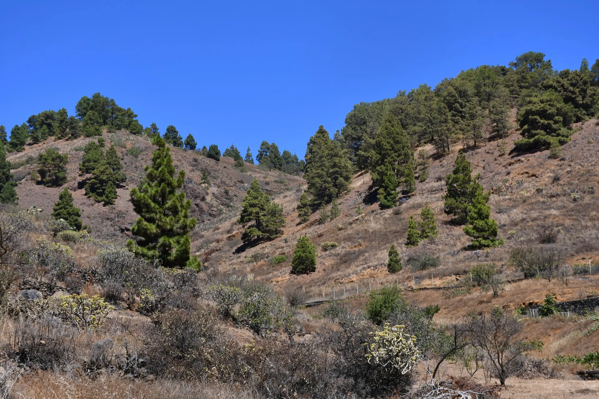
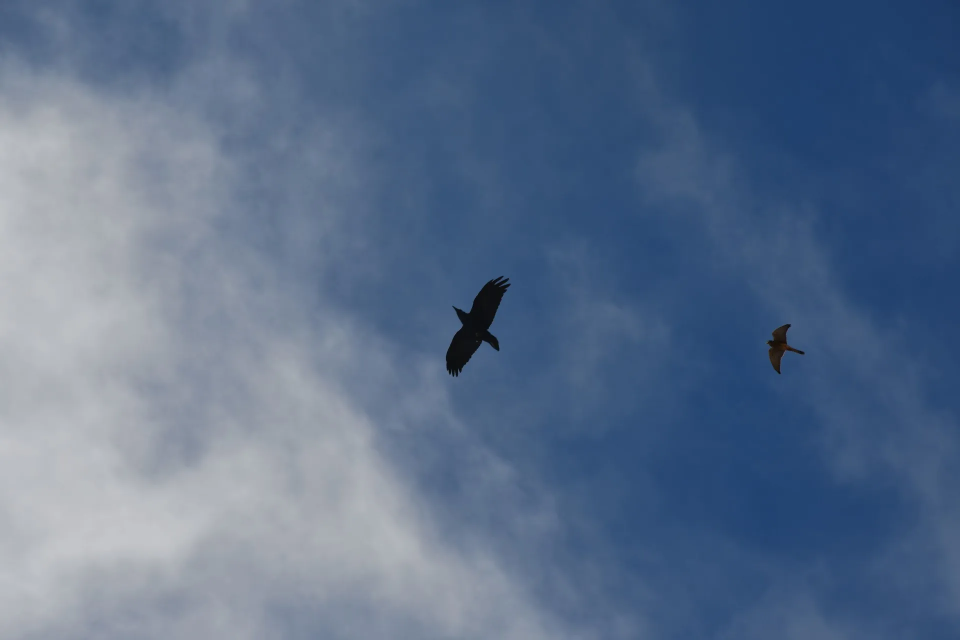
On these slopes, hikers can spot "sabinas" (Juniperus turbinata canariensis), the silent witnesses to the transformation of the land, now adapted for cultivation, mainly of fig trees, almond trees, and grapevines. This area marks a transition zone between pine forest and farmland, making it common to see ravens (Corvus corax canariensis) and kestrels (Falco tinnunculus canariensis) gliding over the landscape.
The "sabina", the symbolic tree of El Hierro, relies on the raven for its natural reproduction and seed dispersal: the hard outer shell of its seeds is softened as it passes through the bird’s digestive system, allowing successful germination. Thanks to the gradual recovery of the raven population on the island, together with controlled "sabina" propagation in nurseries and greenhouses, the future of this remarkable tree species is now assured.
Finally, along Camino del Bérote, visitors can appreciate the ongoing importance of grapevine cultivation to the community of El Pinar. The local wines have achieved international recognition, earning numerous awards and reinforcing the strong winemaking tradition of this mountain village.
Datos Técnicos
| Branch | Ramal 1 |
|---|---|
| Coordinates | 27.700669, -17.986156 |
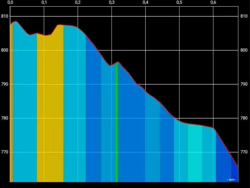
| Maximum altitude | 808 m |
| Minimum altitude | 765 m |
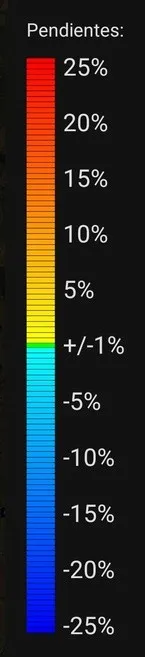
| Distance (Descending) | 0,68 km |
| Duration | 11min 33s |
Pole Location
View the exact location of the pole