R2_P6-P7
Detailed pole information
This pole is part of the trail El Mentidero - El Canto - El Cascajo in the Ramal 2. A strategic point of the route that will help you orient yourself during your journey.
Pole Details
All technical information of the point
Description
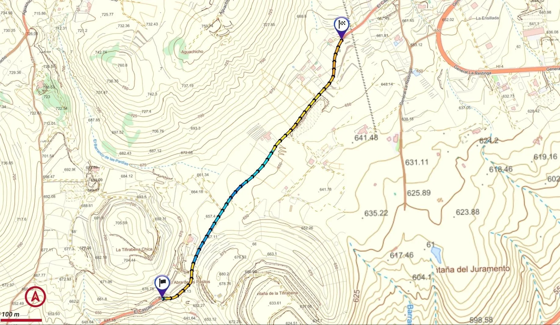
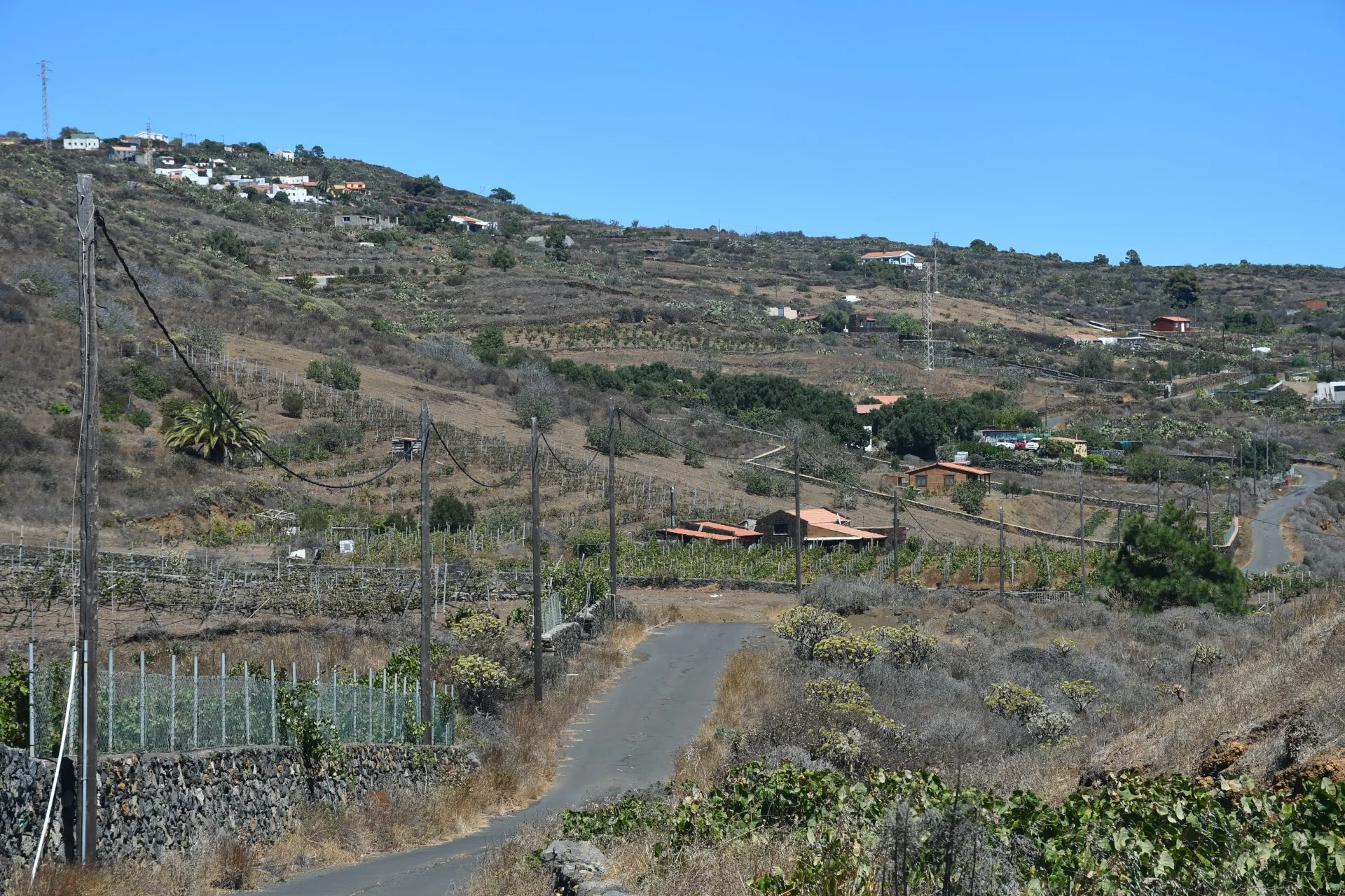
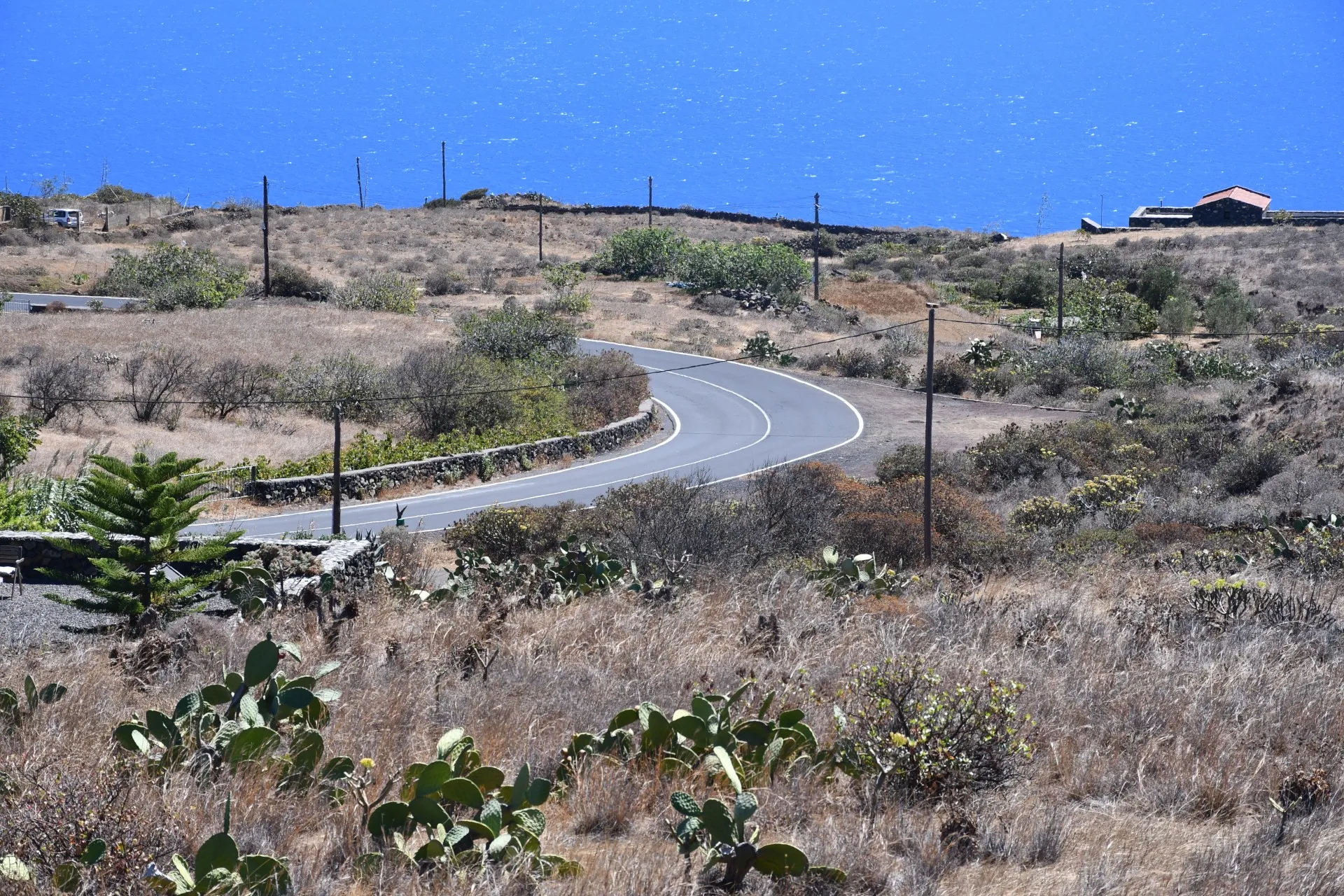
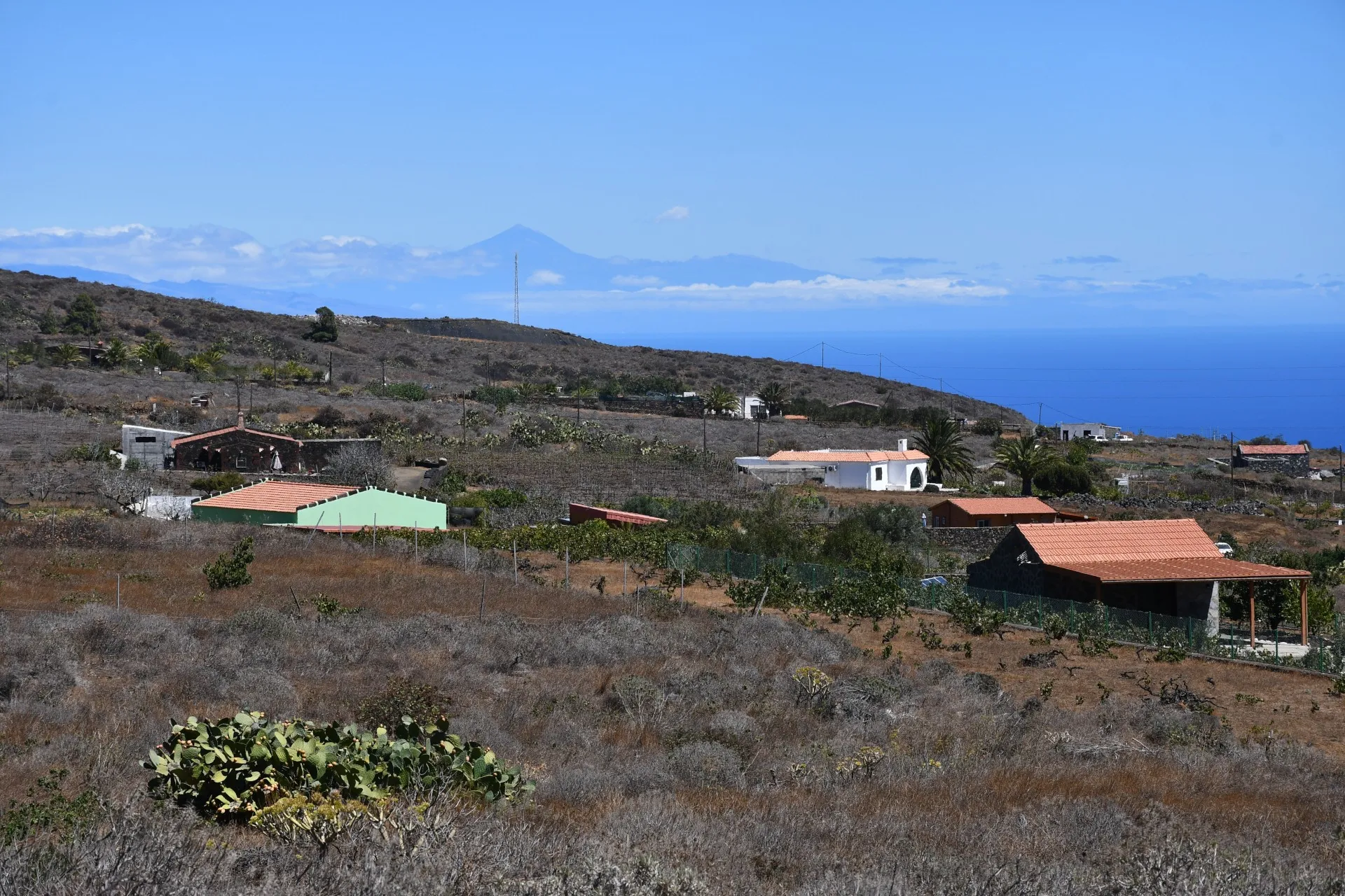
From El Abra de los Pasitos, the trail continues northeast along the paved El Cascajo track, passing through the area known as Aguachicho and ending at Era del Barranco. Along this stretch, the landscape becomes increasingly shaped by human activity as it approaches the dispersed settlement of El Cascajo and the village of El Pinar.
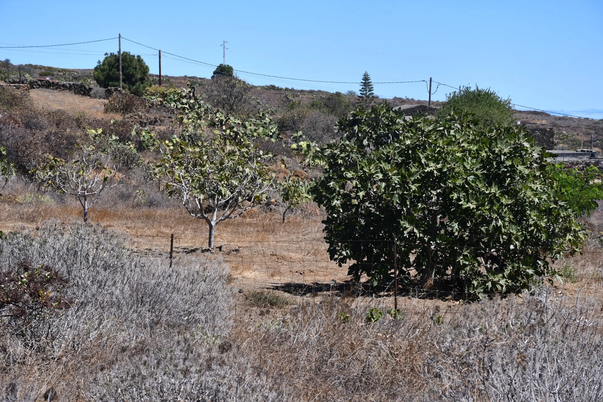
In this area, small agricultural plots are abundant. Some are recently established, such as olive groves (Olea europaea), while others are more traditional, including vineyards (Vitis vinifera) and fig orchards (Ficus carica). Today, agricultural recovery projects have been launched to revive fig cultivation, helping to preserve a tradition that is an essential part of El Hierro’s identity.
For centuries, the fig was a pillar of the island’s traditional economy, serving both as a staple food and as a primary export product. Thanks to its adaptation to dry climates and its preservation as dried figs, sun-dried for storage, it became a highly valued commodity both on and off the island. In the 1960s, El Hierro exported more than 160,000 kilograms of figs, highlighting the significant role this fruit played in the local economy.
Datos Técnicos
| Branch | Ramal 2 |
|---|---|
| Coordinates | 27.686632, -17.985602 |
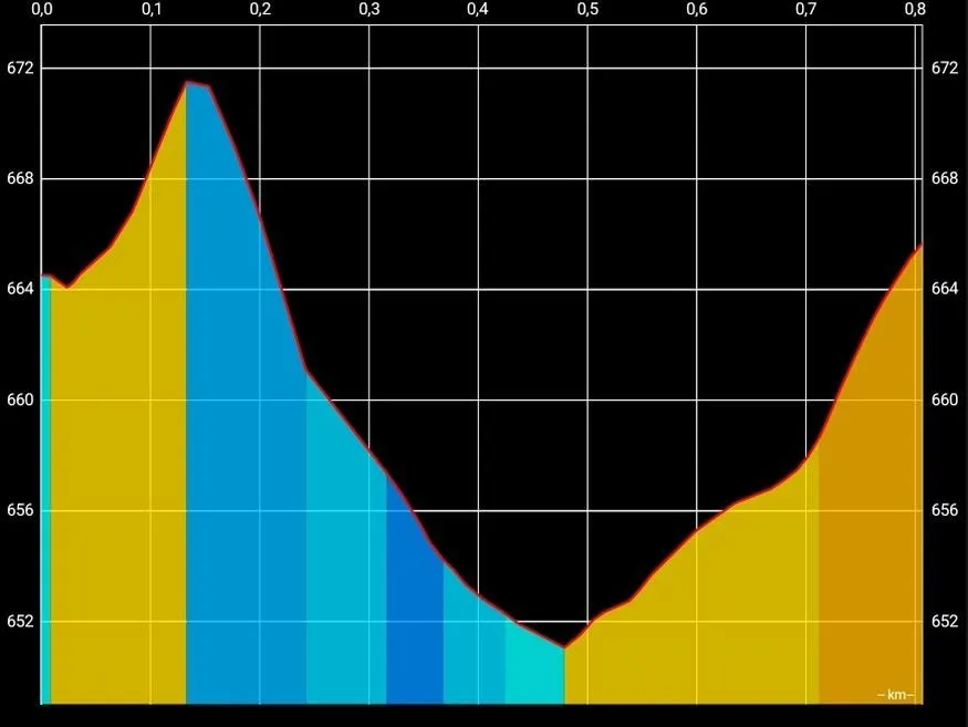
| Maximum altitude | 671 m |
| Minimum altitude | 651 m |
| Distance (Ascending) | 0,49 km |
| Distance (Descending) | 0,32 km |
| Duration | 13min 49s |
Pole Location
View the exact location of the pole